

- Usage in publication:
-
- Ditch Creek Siltstone Member*
- Modifications:
-
- Named
- Biostratigraphic dating
- Dominant lithology:
-
- Siltstone
- Sandstone
- AAPG geologic province:
-
- Klamath Mountains province
Summary:
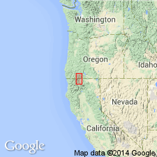
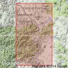
Is third from lowermost member of Hornbrook Formation. Named for outcrops adjacent to Ditch Creek about 3 km west of Hornbrook. Type section designated in road cuts along northbound lane of HWY I-5 about 3 km south of Hornbrook, NE/4 NE/4 sec.32 T47N R6W, Hornbrook 15' quad, Siskiyou Co, CA. Dominantly gray siltstone with interbedded silty very fine-grained sandstone; locally contains mudstone and fine-grained sandstone in lower part. Generally 20 to 80 m thick (62 m thick at type). Conformably overlies Osburger Gulch Sandstone Member (new) (Hornbrook Formation) except in Ashland area where it unconformably overlies basement rocks. Contains locally abundant molluscan fossils including ammonites, pelecypods, gastropods, and foraminifers. Age considered Turonian and Coniacian (Late Cretaceous).
Source: GNU records (USGS DDS-6; Menlo GNULEX).
- Usage in publication:
-
- Ditch Creek Siltstone Member*
- Modifications:
-
- Age modified
- Overview
- Dominant lithology:
-
- Coal
- AAPG geologic province:
-
- Klamath Mountains province
Summary:
Detailed lithology includes coal bed near Hagedorn Ranch adjacent to Yreka-Ager Road about 4.5 km southwest of Willow Creek School, SW/4 SW/4 sec.24 T46W R6W, Copco 15' quad, Siskiyou Co, CA. Measured type section, lists of fossils, depositional environment, and mapping included in study. Age of unit in its main outcrop ranges from early Turonian to early Coniacian based on included fossils.
Source: GNU records (USGS DDS-6; Menlo GNULEX).
For more information, please contact Nancy Stamm, Geologic Names Committee Secretary.
Asterisk (*) indicates published by U.S. Geological Survey authors.
"No current usage" (†) implies that a name has been abandoned or has fallen into disuse. Former usage and, if known, replacement name given in parentheses ( ).
Slash (/) indicates name conflicts with nomenclatural guidelines (CSN, 1933; ACSN, 1961, 1970; NACSN, 1983, 2005, 2021). May be explained within brackets ([ ]).