The National Geologic Map Database is migrating to a new infrastructure. We apologize for any service disruptions during this process.
|
|---|


- Usage in publication:
-
- Dirty Creek sandstone member*
- Modifications:
-
- Original reference
- Dominant lithology:
-
- Sandstone
- AAPG geologic province:
-
- Chautauqua platform
Summary:
Pg. 503-520. Dirty Creek sandstone member of Atoka formation. Thin to massive bedded sandstone, fine- grained, dark blue; color changes from blue to brown and texture from fine- to medium-grained as sandstone is traced from south to north. Surfaces of bedding planes covered with fucoidal markings. Fossils. Thickness 5 to 20 feet. Separated from underlying Georges Fork sandstone member by 60 feet of varicolored shale and from overlying Webbers Falls sandstone member by 40 feet of shale. Age is Pennsylvanian. Report includes geologic map, columnar sections, measured sections.
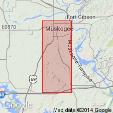
Named from exposure west of Dirty Creek, in secs. 11 and 14, T. 12 N., R. 19 E., Muskogee Co., eastern OK.
Source: US geologic names lexicon (USGS Bull. 896, p. 612); supplemental information from GNU records (USGS DDS-6; Denver GNULEX).
For more information, please contact Nancy Stamm, Geologic Names Committee Secretary.
Asterisk (*) indicates published by U.S. Geological Survey authors.
"No current usage" (†) implies that a name has been abandoned or has fallen into disuse. Former usage and, if known, replacement name given in parentheses ( ).
Slash (/) indicates name conflicts with nomenclatural guidelines (CSN, 1933; ACSN, 1961, 1970; NACSN, 1983, 2005, 2021). May be explained within brackets ([ ]).