The National Geologic Map Database is migrating to a new infrastructure. We apologize for any service disruptions during this process.
|
|---|


- Usage in publication:
-
- Dilworth sand
- Modifications:
-
- Original reference
- Dominant lithology:
-
- Sandstone
- Shale
- Clay
- AAPG geologic province:
-
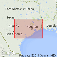
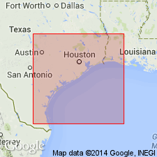
- Gulf Coast basin
Summary:
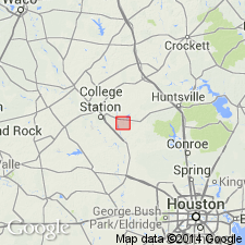
Pg. 1302, 1311, etc. Dilworth sand. Basal zone of Whitsett formation as here defined. At Dilworth, 0.8 mi east of brick schoolhouse, on J. Winclarek 39.5-acre tract in George Blair survey, the Dilworth sand consists of (descending): (1) 8 feet of thin (1 to 2 inches) flaggy, ripple-marked sandstone alternating with layers of green shale and volcanic glass 1 to 2 inches thick; (2) 2 feet of green clay; (3) 3 inches of thin, flaggy, very fine-grained sandstone; (4) 4 feet of green bentonitic shale; (5) 2 inches of thin, flaggy, fine-grained sandstone; (6) 2.5 feet of loose sand with green clay inclusions; (7) 2 feet of chocolate thinly laminated shale with streaks of sand; total 18 feet 11 inches. Underlies Falls City shale. Been traced across Atascosa, Karnes, and Gonzales Counties, southeastern Texas. [Age is late Eocene.]
Source: US geologic names lexicon (USGS Bull. 896, p. 610-611).
- Usage in publication:
-
- Dilworth sand
- Modifications:
-
- Revised
- Areal extent
- AAPG geologic province:
-
- Gulf Coast basin
Summary:
Table opp. p. 17, and p. 34-36. Dilworth sandstone member of Manning formation. In Gonzales County, 0.75 mi southeast of Dilworth, extending across the E. Kramling 50-acre tract, the Wm. Green 144-acre tract, and the Jno. Sewfera 105-acre tract in George Blair survey, there is a persistent sandstone ledge to which Miss Ellisor applied the name Dilworth sand. In Grimes and Brazos Counties there is a very persistent sandstone 50 to 70 feet below Whitsett formation (as here restricted) which was used extensively in mapping structure through Grimes, Brazos, and eastern Washington Counties. This sandstone was not found in western Washington County and in most of Fayette County. On basis of stratigraphic position and interval to base of Catahoula formation, this sandstone has been tentatively correlated with Dilworth sandstone of Miss Ellisor in Gonzales County, though it is recognized the sandstone designated Yuma may be = Dilworth sandstone of Gonzales County. [The table shows his expanded Manning formation (250 to 350 feet thick) as underlying his restricted Whitsett formation (75 to 132 feet thick), and divided his Manning into (descending): (1) same as No. 5, 0 to 25 feet; (2) Yuma sandstone, 3 to 25 feet; (3) same as No. 5, 25 to 40 feet; (4) Dilworth sandstone, 2 to 22 feet; (5) chocolate colored lignitic clay with interbedded tan sand and sandstone and gray tuffaceous sandstone, with thin beds of lignite, some thin fossiliferous marine beds, but mostly nonmarine, thickness not given.] [Age is late Eocene.]
Source: US geologic names lexicon (USGS Bull. 896, p. 610-611).
- Usage in publication:
-
- Dilworth sand
- Modifications:
-
- Areal extent
- AAPG geologic province:
-
- Gulf Coast basin
Summary:
Pg. 166-171. In Grimes and [Brazos] Counties, east-central Texas, unit termed Dilworth by Renick (1936, Univ. Texas Bull., no. 3619) on assumption that it was equivalent to Dilworth of Gonzales County, is here named Tuttle sandstone member of Manning formation.
Source: US geologic names lexicon (USGS Bull. 1200, p. 1119).
- Usage in publication:
-
- Dilworth sandstone member*
- Modifications:
-
- Revised
- AAPG geologic province:
-
- Gulf Coast basin
Summary:
Pg. 2626 (table 1), 2630-2631. Dilworth sandstone member of McElroy formation. Termed sandstone and reallocated to member status in McElroy formation (redefined). Overlies Manning clay member; underlies Conquista clay member (new).
Source: US geologic names lexicon (USGS Bull. 1200, p. 1119).
- Usage in publication:
-
- Dilworth sandstone member*
- Modifications:
-
- Revised
- AAPG geologic province:
-
- Gulf Coast basin
Summary:
Dilworth Sandstone Member of †McElroy Formation (now abandoned) of Jackson Group reassigned as basal member of Whitsett Formation of Jackson Group. Overlies Manning Clay (raised in rank from member of McElroy); underlies Conquista Clay Member (reassigned from McElroy to Whitsett). Present in south-central Texas. Age is late Eocene. (Dilworth Sandstone Member of Whitsett Formation of Jackson Group adopted by the USGS and Texas Geol. Survey.)
Source: Changes in stratigraphic nomenclature, 1972 (USGS Bull. 1394-A, p. A12-A13).

- Usage in publication:
-
- Dilworth Sandstone Member
- Modifications:
-
- Areal extent
- AAPG geologic province:
-
- Gulf Coast basin
Summary:
Dilworth Sandstone Member of Whitsett Formation. Sandstone, fine- to medium-grained, cross-bedded to massive, generally friable, locally well indurated, gray to yellowish brown, abundantly bored by OPHIOMORPHA. Thickness 40 feet. Underlies Conquista Clay Member of Whitsett. Overlies Manning Formation (Eocene). Age is considered Eocene and Oligocene(?).
Not separately mapped. [Present in Karnes Co., southeastern TX.]
Source: Modified from GNU records (USGS DDS-6; Denver GNULEX).

- Usage in publication:
-
- Dilworth Sandstone Member
- Modifications:
-
- Areal extent
- AAPG geologic province:
-
- Gulf Coast basin
Summary:
Dilworth Sandstone Member of Whitsett Formation of Jackson Group. Sandstone, fine- to medium-grained, cross-bedded to massive, some interbedded shale locally at top, fissile, chocolate colored, some carbonaceous tuff locally near base, in lower part abundantly bored by OPHIOMORPHA, contains abundant clay pebbles. Thickness 40 feet. Lies above Manning Formation and below Conquista Clay Member of Whitsett. Age is Eocene.
Not separately mapped. [Present in McMullen, Atascosa, and Karnes Cos., southern TX.]
Source: Publication.
For more information, please contact Nancy Stamm, Geologic Names Committee Secretary.
Asterisk (*) indicates published by U.S. Geological Survey authors.
"No current usage" (†) implies that a name has been abandoned or has fallen into disuse. Former usage and, if known, replacement name given in parentheses ( ).
Slash (/) indicates name conflicts with nomenclatural guidelines (CSN, 1933; ACSN, 1961, 1970; NACSN, 1983, 2005, 2021). May be explained within brackets ([ ]).