

- Usage in publication:
-
- Dick rhyolite*
- Modifications:
-
- Named
- Dominant lithology:
-
- Rhyolite
- AAPG geologic province:
-
- Southwestern Basin-and-Range region
Summary:
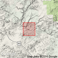
Named for large mass of intrusive rock on Dick Peak, approximately 2 mi southwest of Bagdad, western Yavapai Co, AZ in Southwestern Basin-and-Range region. No type locality designated. North of Dick Peak, intrudes Bridle formation (new) and Butte Falls tuff (new), and is intruded by the gabbro east of King Peak. Resembles King Peak rhyolite except for the presence of quartz phenocrysts. Locally foliated, becoming a quartz-sericite schist. South of Dick Peak contains acicular hornblende xenocrysts presumably derived from Bridle formation. Geologic map. Is considered Precambrian in age.
Source: GNU records (USGS DDS-6; Denver GNULEX).
- Usage in publication:
-
- Dick Rhyolite
- Modifications:
-
- Revised
- Areal extent
- Dominant lithology:
-
- Volcanics
- AAPG geologic province:
-
- Southwestern Basin-and-Range region
Summary:
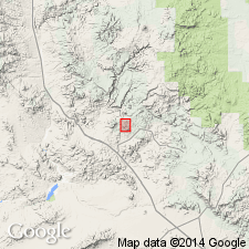
Is mapped and extended southward from the Dick Peak-King Peak area (where originally named by Anderson and others (1955), western Yavapai Co, AZ in Southwestern Basin-and-Range region. Revised to include rhyolite, interbedded felsic volcaniclastics, sedimentary rocks, and andesite flows that overlie Bridle Formation and underlie basalts and felsic tuffs that are part of Butte Falls Tuff. Is considered mostly extrusive because of distribution as thick (about 2 km), central rhyolite porphyry bulge of volcanic origin that thins southward and possibly northward. Interbedded felsic pyroclastics, volcaniclastics, and andesite thin and terminate toward the center of the bulge. Is of intrusive origin in lower part of bulge where unit is apparently continuous with sills that intrude Bridle Formation. Is Early Proterozoic in age. Could be younger than volcanic rocks of Yavapai Series in the Jerome-Prescott area to the east.
Source: GNU records (USGS DDS-6; Denver GNULEX).
- Usage in publication:
-
- Dick Rhyolite*
- Modifications:
-
- Geochronologic dating
- AAPG geologic province:
-
- Southwestern Basin-and-Range region
Summary:
(advance copy). U-Pb age of 1,710 +/-10 Ma determined on zircon. Unit occurs in the Poachie Range area, Yavapai County, Arizona (Southwestern Basin-and-Range region).
Source: GNU records (USGS DDS-6; Denver GNULEX).
For more information, please contact Nancy Stamm, Geologic Names Committee Secretary.
Asterisk (*) indicates published by U.S. Geological Survey authors.
"No current usage" (†) implies that a name has been abandoned or has fallen into disuse. Former usage and, if known, replacement name given in parentheses ( ).
Slash (/) indicates name conflicts with nomenclatural guidelines (CSN, 1933; ACSN, 1961, 1970; NACSN, 1983, 2005, 2021). May be explained within brackets ([ ]).