- Usage in publication:
-
- Diamond A Formation
- Modifications:
-
- Named
- Dominant lithology:
-
- Limestone
- Shale
- Conglomerate
- AAPG geologic province:
-
- Great Basin province
Summary:
Pg. 12-17, pI. 1 (geol. map). Diamond A Formation. Light- to dark-gray, grayish-orange to olive-gray weathering, mostly crystalline, bedded limestone with shale and hornfels members. Lenses of quartzite- and chert-pebble conglomerate near base. Thickness 610 to 1,500 feet [in SE/4 sec. 17, T. 47 N., R. 57 E.]. Unconformably underlies Tertiary Bieroth Andesite (new) or Idavada Volcanics. Lies conformably or unconformably, depending on location, on unnamed Paleozoic argillaceous formation that contains a dark quartzite. Tentatively correlated (on the basis of lithologic similarity) with Banner Formation to the west, in Mountain City quadrangle, and may be included in lower part of Mountain City Formation. Age is considered Carboniferous due to lack of age-diagnostic fossils in Diamond A or Banner. Report includes measured sections, cross sections.
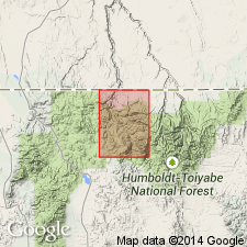
Exposures along north side of Bearpaw Mountain (sec. 17 and N/2 sec. 19, T. 47 N., R. 57 E.; SE/4 sec. 24, T. 47 N., R. 56 E.) and along Bruneau River from Rowland, west of hill 5767, northward to McDonald Creek, northern NV. Named from Diamond A Desert which lies just northwest of Bearpaw Mountain, Rowland quadrangle, Elko Co., NV.
Source: US geologic names lexicon (USGS Bull. 1350, p. 209); GNU records (USGS DDS-6; Menlo GNULEX); GNC index card files (USGS-Menlo).
For more information, please contact Nancy Stamm, Geologic Names Committee Secretary.
Asterisk (*) indicates published by U.S. Geological Survey authors.
"No current usage" (†) implies that a name has been abandoned or has fallen into disuse. Former usage and, if known, replacement name given in parentheses ( ).
Slash (/) indicates name conflicts with nomenclatural guidelines (CSN, 1933; ACSN, 1961, 1970; NACSN, 1983, 2005, 2021). May be explained within brackets ([ ]).

