The National Geologic Map Database is migrating to a new infrastructure. We apologize for any service disruptions during this process.
|
|---|


- Usage in publication:
-
- Dewey Lake formation
- Modifications:
-
- Principal reference
- Dominant lithology:
-
- Sandstone
- Siltstone
- AAPG geologic province:
-
- Permian basin
Summary:
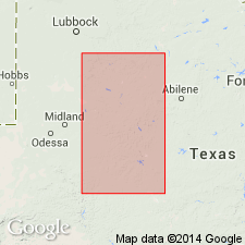
Pg. 62-63. Dewey Lake formation. Consists of orange-red sandstones and silts. Overlies Rustler formation; underlies Tecovas silts. Occurs between depths of 1,155 feet and 1,407 feet in type well. No complete section found in outcrops hence named from subsurface. Triassic-Permian boundary occurs at top of formation. [Age is Late Permian (Ochoa).]
Type section (subsurface): depth-interval 1,155 to 1,407 feet, Penn's Habenstreit No. 1 well, near center sec. 47, Blk. 36, T. 3 S., Texas and Pacific RR survey, Glasscock Co., western TX. Named from Dewey Lake, [Dewey Lake 7.5-min quadrangle, Glasscock Co., western TX].
Source: US geologic names lexicon (USGS Bull. 1200, p. 1109).
- Usage in publication:
-
- Dewey Lake Redbeds*
- Modifications:
-
- Areal extent
- AAPG geologic province:
-
- Permian basin
Summary:
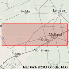
Name Dewey Lake Redbeds applied to rocks above the Rustler Formation and beneath Santa Rosa Sandstone in west (Eddy Co, NM to Loving Co, TX) and beneath Tecovas Formation in east (Winkler to Glassock Cos, TX), Permian basin, that form a single lithologic unit. Assigned to the Permian. Use of Dewey Lake in report area supercedes use of Pierce Canyon Redbeds.
Source: GNU records (USGS DDS-6; Denver GNULEX).
- Usage in publication:
-
- Dewey Lake Redbeds
- Modifications:
-
- Mapped 1:250k
- Dominant lithology:
-
- Siltstone
- Sandstone
- AAPG geologic province:
-
- Permian basin
Summary:
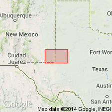
Pamphlet [p. 4]. Dewey Lake Redbeds. Siltstone and fine-grained quartz sandstone, laminated, locally cross-bedded, reddish orange, reddish brown, brownish yellow, greenish-gray reduction spots up to an inch in size common. Thickness 200 to 250 feet. Lies above Rustler Formation (Upper Permian); lies below Santa Rosa Sandstone (Triassic). Age is Late Permian (Ochoan).
[Notable exposures in Maroon Cliffs area, Eddy Co., NM.]
Source: Publication.
For more information, please contact Nancy Stamm, Geologic Names Committee Secretary.
Asterisk (*) indicates published by U.S. Geological Survey authors.
"No current usage" (†) implies that a name has been abandoned or has fallen into disuse. Former usage and, if known, replacement name given in parentheses ( ).
Slash (/) indicates name conflicts with nomenclatural guidelines (CSN, 1933; ACSN, 1961, 1970; NACSN, 1983, 2005, 2021). May be explained within brackets ([ ]).