- Usage in publication:
-
- Devils Peak Member
- Modifications:
-
- Named
- Dominant lithology:
-
- Volcanics
- Breccia
- AAPG geologic province:
-
- Santa Maria basin
Summary:
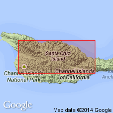
Named as second from uppermost member of Santa Cruz Island Volcanics (new) [authors say Santa Cruz Island Volcanics "informally" divided into members]. Is well exposed [type locality] on south and east slopes of Devils Peak. Best exposures occur on south side of divide and in deep northward draining canyons on north side of crest of hills north of Santa Cruz Island fault. Composed of variety of andesite flows, flow breccias, and reworked pyroclastics, and is characterized by thick units of dark scoriaceous breccia. Color is gray to black. Maximum thickness in outcrop is 2400 ft. Discordantly overlies Stanton Ranch Member (new). Discordantly underlies Prisoners Harbor Member (new). Text states that no precise age is available for volcanic rocks, "but entire pile was presumably emplaced within Saucesian Stage of upper Oligocene and lower Miocene," p.94. Age on map shown as Miocene.
Source: GNU records (USGS DDS-6; Menlo GNULEX).

- Usage in publication:
-
- Devils Peak Member*
- Modifications:
-
- Adopted
- Geochronologic dating
- AAPG geologic province:
-
- Santa Maria basin
Summary:
Santa Cruz Island Volcanics (Nolf and Nolf, 1969) and its members (ascending); Griffith Canyon, Stanton Ranch, Devils Peak, and Prisoners Harbor are adopted. Dike cutting lower part of Devils Peak Member 1.5 km southwest of Red Peak yielded ages of 19.4 +/-0.9 Ma (plagioclase age) and 15.5 +/-0.7 Ma (whole rock age). Shown on generalized geologic sketch map of north-central Santa Cruz Island as of Tertiary age.
Source: GNU records (USGS DDS-6; Menlo GNULEX).
For more information, please contact Nancy Stamm, Geologic Names Committee Secretary.
Asterisk (*) indicates published by U.S. Geological Survey authors.
"No current usage" (†) implies that a name has been abandoned or has fallen into disuse. Former usage and, if known, replacement name given in parentheses ( ).
Slash (/) indicates name conflicts with nomenclatural guidelines (CSN, 1933; ACSN, 1961, 1970; NACSN, 1983, 2005, 2021). May be explained within brackets ([ ]).

