- Usage in publication:
-
- Devil's Kitchen member
- Modifications:
-
- Named
- Dominant lithology:
-
- Sandstone
- Shale
- Limestone
- AAPG geologic province:
-
- South Oklahoma folded belt
Summary:
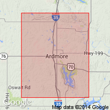
Named as a member of the Deese formation (raised in rank) in the Ardmore basin of southern OK in S. Oklahoma folded belt province; name taken from a glen in sec 10, T6S, R2E, Love Co, OK. No type locality designated. Forms a conspicuous oak-clad ridge, 50-150 ft in height along most of its outcrop. Consists of (ascending): at base, a medium-grained buff sandstone 100-200 ft thick; a shale interval with 10 ft or more of fossiliferous impure limestone and calcareous shale; at top, thick sandstone with chert grains, developing southeastward from Ardmore into a coarse conglomerate of angular to subangular chert pebbles. Sandstone is thicker and more dominant southeastward as far as the member can be traced, to its easternmost outcrop in sec 29, T6S, R3E. Lies about 800 ft above base of Deese or top of Pumpkin Creek member (new) of the Dornick Hills formation (new); lies approximately 1900 ft below Arnold member (new) of the Deese. Fossil list; geologic map; columnar section. Of Pennsylvanian age.
Source: GNU records (USGS DDS-6; Denver GNULEX).
For more information, please contact Nancy Stamm, Geologic Names Committee Secretary.
Asterisk (*) indicates published by U.S. Geological Survey authors.
"No current usage" (†) implies that a name has been abandoned or has fallen into disuse. Former usage and, if known, replacement name given in parentheses ( ).
Slash (/) indicates name conflicts with nomenclatural guidelines (CSN, 1933; ACSN, 1961, 1970; NACSN, 1983, 2005, 2021). May be explained within brackets ([ ]).

