- Usage in publication:
-
- Devils Hole dolomite
- Modifications:
-
- First used
- Dominant lithology:
-
- Dolomite
- AAPG geologic province:
-
- Appalachian basin
Summary:
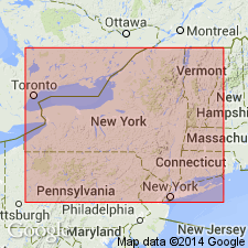
Name used to refer to eastwardly thinning wedge of dolomite carrying Guelph fauna in Niagara Gorge. Name replaces preoccupied Lower Shelby of Clarke (1903). Underlies Oakfield limestone and overlies Eramosa dolomite. Age is Lockportian [late Niagaran, mid Wenlock-early Ludlow].
Source: GNU records (USGS DDS-6; Reston GNULEX).
For more information, please contact Nancy Stamm, Geologic Names Committee Secretary.
Asterisk (*) indicates published by U.S. Geological Survey authors.
"No current usage" (†) implies that a name has been abandoned or has fallen into disuse. Former usage and, if known, replacement name given in parentheses ( ).
Slash (/) indicates name conflicts with nomenclatural guidelines (CSN, 1933; ACSN, 1961, 1970; NACSN, 1983, 2005, 2021). May be explained within brackets ([ ]).

