- Usage in publication:
-
- Devil's Graveyard Formation
- Modifications:
-
- Original reference
- Dominant lithology:
-
- Tuff
- Mudstone
- Sandstone
- AAPG geologic province:
-
- Permian basin
Summary:
Devil's Graveyard Formation of the Buck Hill Group. The Devil's Graveyard Formation of the Buck Hill Group, here named, is in the Agua Fria-Green Valley area of Trans-Pecos, Texas. Consists of volcaniclastic tuff, bentonitic tuff, mudstone, and sandstone and is divided into informal lower and middle members and the upper Bandera Mesa Member (new). Marker beds useful for correlation are informally named the Junction facies, Variegated beds, Lunch Locality sandstone, Northeast facies, Car Park conglomerate, Strawberry tuff, Titanothere channels, Purple Bench tuff, Skyline channels, Cotter channels, and Upper breccia-conglomerate. Unconformably overlies Cretaceous rocks; underlies the Mitchell Mesa Rhyolite or the informal Yellow conglomerate. Thickness is 1,635 feet. Age is Eocene and Oligocene based on vertebrate fauna.
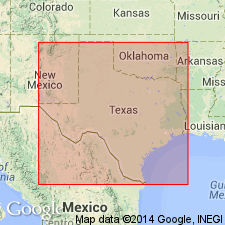
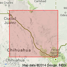
Type area: Devil's Graveyard, along Alamo de Cesario Creek and the south face of Bandera Mesa, Agua Fria and Tascotal Mesa quadrangles, Brewster and Presidio Counties, Texas. Reference sections and boundary stratotypes are designated.
Source: US geologic names lexicon (USGS Bull. 1565, p. 85-86).

- Usage in publication:
-
- Devils Graveyard Formation
- Modifications:
-
- Geochronologic dating
- AAPG geologic province:
-
- Permian basin
Summary:
Pg. 23. Devils Graveyard Formation. Includes lower member, middle member, and Bandera Mesa Member (upper member). Lower member; samples from basalt flows overlying sediment with middle to very early late Eocene vertebrates, in Hen Egg Mountain quadrangle, Brewster County, yielded K-Ar ages of 53.6 +/-2.4 Ma and 46.2 +/-0.9 Ma (whole-rock), and samples from tuffaceous sediment and air-fall tuffs overlying and underlying sediments containing earliest late Eocene vertebrates, in [Agua Fria Mountain] quadrangle, Brewster County, southwestern Texas, yielded K-Ar ages 49.7 +/-1.2 Ma (plagioclase), 46.9 +/-1.0 Ma (alkali feldspar), and 43.9 +/-0.7 Ma (biotite). Middle member; sample from air-fall tuff overlying sediments containing late Eocene vertebrates and underlying early Oligocene faunas, in Tascotal Mesa quadrangle, Presidio County, yielded a K-Ar age of 42.8 +/-1.6 Ma (biotite). Bandera Mesa Member; tuff and basalt flow samples from McKinney Mountain and Tascotal Mesa quadrangles, Presidio County, southwestern Texas, yielded K-Ar ages of 33.7 +/-1.7 Ma and 33.2 +/-1.5 Ma (whole-rock), respectively; [see also entry under Bandera Mesa]. Data from R.L. Erickson, 1953 (GSA Bull., v. 64, p. 1353-1386), and J.B. Stevens and others, 1984 (Univ. Texas-Austin, Texas Mem. Mus. Bull. 32, 21 p.); ages recalculated using decay constants of Steiger and Jager, 1977 (Earth Planet. Sci. Letters, v. 36, p. 359-362).
[Age considered Eocene to Oligocene; Eocene-Oligocene boundary 36.6 (38-34) Ma (from Geologic Names Committee, USGS, 1983 ed. geol. time scale, with additions from N.J. Snelling, 1985, The Geol. Soc. Mem., no. 10).]
Source: Publication.
For more information, please contact Nancy Stamm, Geologic Names Committee Secretary.
Asterisk (*) indicates published by U.S. Geological Survey authors.
"No current usage" (†) implies that a name has been abandoned or has fallen into disuse. Former usage and, if known, replacement name given in parentheses ( ).
Slash (/) indicates name conflicts with nomenclatural guidelines (CSN, 1933; ACSN, 1961, 1970; NACSN, 1983, 2005, 2021). May be explained within brackets ([ ]).

