

- Usage in publication:
-
- Devil Creek Member
- Modifications:
-
- Named
- Biostratigraphic dating
- Reference
- Dominant lithology:
-
- Limestone
- AAPG geologic province:
-
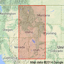
- Great Basin province
- Wasatch uplift
Summary:
Named as upper member (of 3) of newly named Henderson Canyon Formation from Devil Creek in Malad Valley east of Samaria Mountains, southeastern ID. Type section where member is 30 m thick is upper part of type Henderson Canyon Formation, including upper part of member C and member D (Wickwire and others, 1985), and upper part of member 3 and member 4 [of Lodgepole Limestone] (Beus, 1968) in S1/2 sec 12, T16S, [R35E], Oneida Co, UT. Reference section designated (but not described) at Leatham Hollow, UT, where it is 58.2 m thick. Occurs in northeastern UT and southeastern ID, Great Basin province and Wasatch uplift. Beds lie within upper cliff or upper cliff and overlying slope of Henderson Canyon Formation. Consists of light to medium-gray grainstones with few wackestones, which weather the same color, are thin to medium bedded, with moderately common graded beds. In upper half, discontinuous nodular black chert bands usually present. Fossils abundant where unit is not dolomitized. Crinoidal debris, solitary corals, ostracods dominate; gastropods and brachiopods less common; conodonts are rare. Overlies Brush Canyon Member (new) of Henderson Canyon Formation. Overlain by Monroe Canyon Formation. Correlation chart. Fossil list. Of late Kinderhookian and Osagean, Early Mississippian age. Upper part is in the GNATHODUS TYPICUS Zone (conodont zone).
Source: GNU records (USGS DDS-6; Denver GNULEX).
For more information, please contact Nancy Stamm, Geologic Names Committee Secretary.
Asterisk (*) indicates published by U.S. Geological Survey authors.
"No current usage" (†) implies that a name has been abandoned or has fallen into disuse. Former usage and, if known, replacement name given in parentheses ( ).
Slash (/) indicates name conflicts with nomenclatural guidelines (CSN, 1933; ACSN, 1961, 1970; NACSN, 1983, 2005, 2021). May be explained within brackets ([ ]).