- Usage in publication:
-
- Descon Formation*
- Modifications:
-
- Named
- Biostratigraphic dating
- Dominant lithology:
-
- Graywacke
- Basalt
- Mudstone
- AAPG geologic province:
-
- Alaska Southeastern region
Summary:
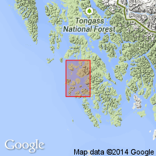
Named for typical exposures at type locality in vicinity of triangulation station at Descon, on southern Heceta Island [55 deg 43'N, 133 deg 32'W] southeastern AK. Composed of predominantly graywacke with interbeds of banded siltstone mudstone, and fine-grained to very fine-grained sandstone. Also consists of the following: interbedded conglomerate and sedimentary breccia, with clasts of basaltic rocks, banded siltstone, graywacke, chert and rare limestone and granitic rocks; thin-bedded black cherty shale and siltstone with graptolitic shale partings and minor thin dark-gray limestone lenses; pistachio-green colored, massive quartzo-feldspathic sandstone; basaltic tuff, breccia, and lava with locally developed pillow structure; and, local massive fine-grained crystalline limestone. Thickness is at least 10,000 ft and may be thicker. Conformably underlies Heceta Limestone (new) or unconformably underlies Karheen Formation (new). Base not exposed. Age is Early Ordovician through Early Silurian based on biostratigraphic dating of graptolites.
Source: GNU records (USGS DDS-6; Menlo GNULEX).
For more information, please contact Nancy Stamm, Geologic Names Committee Secretary.
Asterisk (*) indicates published by U.S. Geological Survey authors.
"No current usage" (†) implies that a name has been abandoned or has fallen into disuse. Former usage and, if known, replacement name given in parentheses ( ).
Slash (/) indicates name conflicts with nomenclatural guidelines (CSN, 1933; ACSN, 1961, 1970; NACSN, 1983, 2005, 2021). May be explained within brackets ([ ]).

