

- Usage in publication:
-
- Derry series
- Modifications:
-
- Named
- Dominant lithology:
-
- Limestone
- Shale
- Conglomerate
- Sandstone
- Coal
- AAPG geologic province:
-
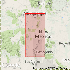
- Orogrande basin
- San Juan basin
Summary:
Term Derry series proposed for all rocks in the central to extreme south-central areas of NM between base of Pennsylvanian system and basal part of Pennsylvanian Des Moines series. Type locality is section measured on west-facing slope of hill about 3/4 mi east of center of village of Derry (for which it is named) near center of sec 32, T17S, R4W, Sierra Co, NM in Orogrande basin. Subdivided into two groups and four formations recognizable over large areas of NM which vary locally in thickness and lithology (all new, ascending): Green Canyon group, divided into Arrey and Apodaca formations; and Mud Springs group, divided into Hot Springs and Cuchillo Negro formations. At no place has base of Derry been examined in NM where it is conformable on older rock. At type overlies Devonian Percha shale; underlies Des Moines sediments--Armendaris group, new name--at all exposures yet observed. No great stratigraphic break between Derry and Des Moines. Widely distributed in North America and in other regions of the world. In NM occurs from San Juan basin of northwestern NM to Hueco and Franklin Mountains, west TX. In NM consists of marine limestones, shales, conglomerates, and coarse sandstones; locally, in lower portion, contains dark shales, sandstones, and thin coal beds. Is 130 ft thick at type. Faunas are large and varied, with abundant brachiopods, corals, crinoids, gastropods, and Foraminifera; plant fossils in basal dark shale.
Source: GNU records (USGS DDS-6; Denver GNULEX).
For more information, please contact Nancy Stamm, Geologic Names Committee Secretary.
Asterisk (*) indicates published by U.S. Geological Survey authors.
"No current usage" (†) implies that a name has been abandoned or has fallen into disuse. Former usage and, if known, replacement name given in parentheses ( ).
Slash (/) indicates name conflicts with nomenclatural guidelines (CSN, 1933; ACSN, 1961, 1970; NACSN, 1983, 2005, 2021). May be explained within brackets ([ ]).