- Usage in publication:
-
- Depot Mountain Formation
- Modifications:
-
- Named
- Dominant lithology:
-
- Slate
- Graywacke
- AAPG geologic province:
-
- New England province
Summary:
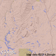
A sequence of slate and graywacke in northern ME, largely equivalent to the "Depot Mountain sequence" of Boudette and others (1976), is here named the Depot Mountain Formation. It consists of dark-gray, fine-grained, well cleaved, laminated slate interlayered with gray, medium- to coarse-grained foliated, lithic graywacke. The graywacke contains quartz, siltstone, and pelite clasts in a matrix of muscovite, chlorite, and biotite. Conglomerate beds are present in the formation. The [informal] "Aquagene Tuff Member" is a 900 m section of water-laid volcanoclastic felsic tuff interlayered with granule to pebble conglomerate which has been mapped from Depot Mountain to Bruleau Pond. The lower contact of the Depot Mountain may be a fault contact with the "Estcourt Road sequence." Conformably or disconformably underlies the Fivemile Brook Formation. Thickness is 2,000 m. Age is Ordovician-Silurian based on stratigraphic position and lithologic similarity to the Cabano Formation of Quebec. Boudette and others (1976) report Middle Ordovician graptolites from slate below the Aquagene.
Source: GNU records (USGS DDS-6; Reston GNULEX).

- Usage in publication:
-
- Depot Mountain Formation
- Modifications:
-
- Revised
- AAPG geologic province:
-
- New England province
Summary:
The preliminary discussion in Roy (1980) is here revised. The Depot Mountain Formation overlies, along the Dead Brook fault, the Estcourt Road Formation. Age is Late Ordovician (Caradocian) and possibly Early Silurian based on correlation with the Cabano Formation and possibly the Pointe Aux Trembles Formation in Quebec.
Source: GNU records (USGS DDS-6; Reston GNULEX).

- Usage in publication:
-
- Depot Mountain Formation
- Modifications:
-
- Overview
- AAPG geologic province:
-
- New England province
Summary:
Depot Mountain Formation recently divided into unnamed lower and upper members in the belt between Seven Islands and Riviere Bleue. The conglomerate subunit of Boudette et al (1976) is not mappable. Rocks similar to those of the type locality are here assigned to the lower member, which consists of thick-bedded, dark gray, fine-to-coarse grained, feldspathic graywacke interbedded with dark gray and black slate or phyllite. Sequences of lithic and crystal tuff and roundstone conglomerate occur locally within lower member. Upper member consists of dark gray, foliated, lithic graywacke interbedded with laminated gray slate. Thickness of the lower member is unknown; upper member may exceed 1000 m. Graptolites from lower member yield Late Ordovician (Caradocian) age. Upper member younger than overlying Fivemile Brook Formation. Therefore, rocks assigned to Depot Mountain appear to extend in age from at least Caradocian to the middle of the Llandoverian (Early Silurian). Along Dead Brook fault, unit overlies St. Daniel Formation, extended from CAN to replace the name Estcourt Road Formation of earlier reports.
Source: GNU records (USGS DDS-6; Reston GNULEX).
For more information, please contact Nancy Stamm, Geologic Names Committee Secretary.
Asterisk (*) indicates published by U.S. Geological Survey authors.
"No current usage" (†) implies that a name has been abandoned or has fallen into disuse. Former usage and, if known, replacement name given in parentheses ( ).
Slash (/) indicates name conflicts with nomenclatural guidelines (CSN, 1933; ACSN, 1961, 1970; NACSN, 1983, 2005, 2021). May be explained within brackets ([ ]).

