- Usage in publication:
-
- Depoe Bay Basalt*
- Modifications:
-
- Named
- Geochronologic dating
- Dominant lithology:
-
- Basalt
- AAPG geologic province:
-
- Oregon-Washington Coast Ranges province
Summary:
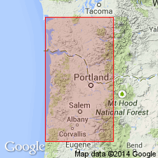
Named after coastal town of Depoe Bay. Type locality designated as outcrop belt that extends 1.5 km north to 2.5 km south of bridge over entrance to inner harbor of Depoe Bay, and that extends from eastern shoreline of outer bay to inner bay in sec. 5, 8, and 17, T9S R11W, Cape Foulweather 15' quad, Lincoln Co., OR. Composed of gray, aphanitic to fine-grained basalt. Includes subaerial and submarine flows. Is 30 m thick at type, ranges 30-200 m thick. Unconformably overlies Astoria Formation. Unconformably underlies Cape Foulweather Basalt (new). Radiometric (K-Ar) ages of 16 +/-0.65 Ma, 14.5 +/-1.0 Ma, and 14 +/-2.7 Ma are reported. Age is middle Miocene.
Source: GNU records (USGS DDS-6; Menlo GNULEX).
For more information, please contact Nancy Stamm, Geologic Names Committee Secretary.
Asterisk (*) indicates published by U.S. Geological Survey authors.
"No current usage" (†) implies that a name has been abandoned or has fallen into disuse. Former usage and, if known, replacement name given in parentheses ( ).
Slash (/) indicates name conflicts with nomenclatural guidelines (CSN, 1933; ACSN, 1961, 1970; NACSN, 1983, 2005, 2021). May be explained within brackets ([ ]).

