- Usage in publication:
-
- Denham Springs Alloformation
- Modifications:
-
- Named
- Dominant lithology:
-
- Silt
- Sand
- Soil
- AAPG geologic province:
-
- Gulf Coast basin
Summary:
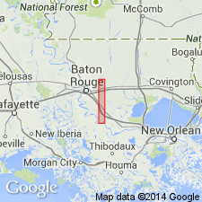
Probably named for town of Denham Springs. Type locality in meander belt segment (covering 14.3 km) of middle Amite River drainage basin north of Denham Springs (town), Denham Springs and Watson 7.5-min quads, western Livingston Parish, southeastern LA. Identified as a continuous abandoned meander belt that approximately coincides with center of Amite River's alluvial valley; slightly more extensive toward southern edge of study area where cross-valley width is about 1,200 m. Surface of unit has well preserved point bar and abandoned channels. Consists of basal sandy facies, in turn blanketed by a lower gray silt (partly oxidized, as well as with reduced components), and crowned by brown silt at land surface. Soils developed in silty facies are mostly Dystrochrepts with A-Bw-C horizons. Plant rooting, worm burrows, and weak crumb structure are primary pedogenic features. Where unit is bounded by modern channel, cutbanks expose as much as 5 m of alluvium. Holocene Denham Springs Alloformation is of intermediate age between younger Holocene Magnolia Bridge Alloformation (new) and older Holocene Watson Alloformation (new). Each alloformation is bounded by a contact between its basal sandy alluvium or lag gravel and the unconformably underlying laminated clayey facies of late Pleistocene Prairie Complex (revised). Report includes geologic sketch maps and cross sections.
Source: GNU records (USGS DDS-6; Denver GNULEX).
For more information, please contact Nancy Stamm, Geologic Names Committee Secretary.
Asterisk (*) indicates published by U.S. Geological Survey authors.
"No current usage" (†) implies that a name has been abandoned or has fallen into disuse. Former usage and, if known, replacement name given in parentheses ( ).
Slash (/) indicates name conflicts with nomenclatural guidelines (CSN, 1933; ACSN, 1961, 1970; NACSN, 1983, 2005, 2021). May be explained within brackets ([ ]).

