- Usage in publication:
-
- Denham Formation
- Modifications:
-
- Named
- Dominant lithology:
-
- Conglomerate
- Siltstone
- Volcanics
- Quartzite
- AAPG geologic province:
-
- Lake Superior region
Summary:
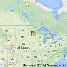
Is lowest unit in Mille Lacs Group (new). Named for sequence of quartz-rich sedimentary rocks that extend in a broad belt from near Denham in northwest Pine Co to vicinity of Mille Lacs Lake, east-central MN in Lake Superior region. Type locality designated for exposures in abandoned river valley in SE1/4 sec 25 and NE1/4 sec 26, T45N, R21W, Pine Co, MN. Is heterogeneous, consisting of arenitic quartz-rich rocks of variable grain size (conglomerate to siltstone). Minor intercalated dolomite, pillowed basalt, and agglomerate at type locality. In subsurface, near McGrath, contains laminated hematitic and cherty iron-formation, and west of Denham, contains quartzite and interbedded quartz-rich phyllite. Elsewhere, stratigraphically higher parts contain quartz-rich argillite, minor dolomite and chert, and massive beds of vitreous quartzite. The latter was formerly known as Dam Lake quartzite of Grout and Wolff (1955). Basal conglomerates derived from underlying McGrath Gneiss. Overlain by or laterally equivalent to Glen township Formation (new) and possibly Randall Formation. Detailed lithology, geologic map. Is assigned middle Precambrian age.
Source: GNU records (USGS DDS-6; Denver GNULEX).
For more information, please contact Nancy Stamm, Geologic Names Committee Secretary.
Asterisk (*) indicates published by U.S. Geological Survey authors.
"No current usage" (†) implies that a name has been abandoned or has fallen into disuse. Former usage and, if known, replacement name given in parentheses ( ).
Slash (/) indicates name conflicts with nomenclatural guidelines (CSN, 1933; ACSN, 1961, 1970; NACSN, 1983, 2005, 2021). May be explained within brackets ([ ]).

