

- Usage in publication:
-
- Delaney gravel
- Modifications:
-
- Original reference
- Dominant lithology:
-
- Flint
- Chert
- Quartz
- Feldspar
- AAPG geologic province:
-
- Ouachita folded belt
Summary:
Pg. 87-88. Delaney gravel. Scattered gravel deposit consisting of flint, chert, quartz, and some feldspar pebbles. Lower than Uvalde formation. [Age is Quaternary.]
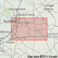
Tops a hill 245 feet above Colorado River level on Delaney Ranch, along Bee Caves Road, 3 mi east of Austin, Travis Co., central TX. Also occurs along ridge between Barton Creek and Fredericksburg Road and southeast of mouth of Bull Creek.
Source: US geologic names lexicon (USGS Bull. 1200, p. 1077).
- Usage in publication:
-
- Delaney gravel
- Modifications:
-
- Redefined
- Dominant lithology:
-
- Flint
- Chert
- Quartz
- Feldspar
- Limestone
- AAPG geologic province:
-
- Ouachita folded belt
Summary:
Pg. 1705. Mathis described Delaney gravel, located west of Austin and occupying a level between the Uvalde and Asylum deposits. Since abundant limestone material is present in Uvalde and younger deposits, Mathis' omission of limestone pebbles in discussion of the Delaney suggests that either he failed to see them or that the Delaney came down from higher levels as erosion progressed and therefore is not in place.
Source: US geologic names lexicon (USGS Bull. 1200, p. 1077).
For more information, please contact Nancy Stamm, Geologic Names Committee Secretary.
Asterisk (*) indicates published by U.S. Geological Survey authors.
"No current usage" (†) implies that a name has been abandoned or has fallen into disuse. Former usage and, if known, replacement name given in parentheses ( ).
Slash (/) indicates name conflicts with nomenclatural guidelines (CSN, 1933; ACSN, 1961, 1970; NACSN, 1983, 2005, 2021). May be explained within brackets ([ ]).