The National Geologic Map Database is migrating to a new infrastructure. We apologize for any service disruptions during this process.
|
|---|


- Usage in publication:
-
- [Del Puerto Volcanics, unranked]
- Modifications:
-
- [First used]
- Dominant lithology:
-
- [Volcanics]
- AAPG geologic province:
-
- San Joaquin basin
Summary:
Pg. 231 (table 8), 233, 244. [Del Puerto Volcanics, unranked, in Franciscan Formation.] Mentioned in discussion of jadeite deposits in California. Name credited to M.E. Maddock (1955, unpub. thesis).
Source: US geologic names lexicon (USGS Bull. 1350, p. 202).
- Usage in publication:
-
- Del Puerto Keratophyre Member
- Modifications:
-
- Areal extent
- Dominant lithology:
-
- Volcanics
- AAPG geologic province:
-
- San Joaquin basin
Summary:
Del Puerto Keratophyre Member of Franciscan Formation. Flows of keratophyre and quartz keratophyre form single elongated body extending nearly 5 miles southward from Del Puerto Creek. Structural considerations indicate these volcanic rocks occur stratigraphically near top of Franciscan section directly beneath Lotta Creek Tuff Member (new). Estimated thickness 1,500 feet. Completely bounded by faults. Body interpreted as anticlinal piercement through Cretaceous strata, north end of which is truncated by Tesla-Ortigalita fault. Age is Late Jurassic(?).
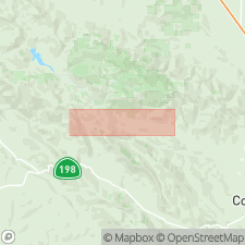
Well exposed along Del Puerto Creek in SE/4 sec. 4, T. 6 S., R. 6 E., Stanislaus Co., central CA.
Source: Publication; US geologic names lexicon (USGS Bull. 1350, p. 202, 441).
For more information, please contact Nancy Stamm, Geologic Names Committee Secretary.
Asterisk (*) indicates published by U.S. Geological Survey authors.
"No current usage" (†) implies that a name has been abandoned or has fallen into disuse. Former usage and, if known, replacement name given in parentheses ( ).
Slash (/) indicates name conflicts with nomenclatural guidelines (CSN, 1933; ACSN, 1961, 1970; NACSN, 1983, 2005, 2021). May be explained within brackets ([ ]).