

- Usage in publication:
-
- Del Norte Formation
- Modifications:
-
- Named
- Dominant lithology:
-
- Shale
- Sandstone
- Limestone
- AAPG geologic province:
-
- Orogrande basin
Summary:
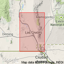
Named for Rio Bravo del Norte (Rio Grande). Type section is in NW1/4 sec 15, T29S, R4E, Smeltertown quad, Dona Ana Co, NM, Orogrande basin where outcrops occur between and adjacent to railroad tracks and just west of Rio Grande floodplain. Areas of greatest exposures are on northern and eastern sides of Cerro de Cristo Rey intrusion, Dona Ana Co, NM and Chihuahua, MX. Divided into lower clay member and upper calcareous member. Lower member consists of calcareous clay shale with interbedded layers of fine-grained sandstone and nodular limestone; type lower member is adjacent to and west of kilns at brick plant in NW1/4 SW1/4 NW1/4 sec 15; here lower member is 44 ft thick. Upper member consists of fossiliferous, medium-gray limestone interbedded with dark-yellowish-brown shale; type is between railroad tracks in SW1/4 NW1/4 NW1/4 sec 15 where member is best exposed; here upper member is 12.5 ft thick. Conformably overlies Finlay Limestone; conformably underlies Smeltertown Formation (new). Geologic maps; cross sections; chart comparing nomenclature used in area. Equivalent to Bose's (1910, Inst. Geol. Mexico, Bol. 25) units 2 and 3. Early Cretaceous (Comanchean and Albian) age based on fossils (listed) recorded by Bose (1910). [Shown on nomenclature chart as late Albian; in text, lower member stated to be in middle part of Albian and upper member stated to be near middle-late Albian time boundary.]
Source: GNU records (USGS DDS-6; Denver GNULEX).
For more information, please contact Nancy Stamm, Geologic Names Committee Secretary.
Asterisk (*) indicates published by U.S. Geological Survey authors.
"No current usage" (†) implies that a name has been abandoned or has fallen into disuse. Former usage and, if known, replacement name given in parentheses ( ).
Slash (/) indicates name conflicts with nomenclatural guidelines (CSN, 1933; ACSN, 1961, 1970; NACSN, 1983, 2005, 2021). May be explained within brackets ([ ]).