The National Geologic Map Database is migrating to a new infrastructure. We apologize for any service disruptions during this process.
|
|---|


- Usage in publication:
-
- Degonia sandstone
- Modifications:
-
- Named
- Dominant lithology:
-
- Sandstone
- AAPG geologic province:
-
- Illinois basin
Summary:
Named Degonia sandstone. Massive cliff-forming sandstone. In some sections, and perhaps all, consists partly of thin-bedded or almost shaly sandstone. Commonly about 100 ft thick. Underlain by Clore limestone; overlain by Kinkaid limestone.
Source: GNU records (USGS DDS-6; Reston GNULEX).
- Usage in publication:
-
- Degonia Sandstone*
- Modifications:
-
- Overview
- AAPG geologic province:
-
- Illinois basin
Summary:
Designated Degonia Sandstone in westernmost KY. "Shale and siltstone: Shale is gray, silty; contains some siltstone. Siltstone is dark greenish gray, in lenses commonly 1 inch thick. Chlorite clay in siltstone common. Unit crops out locally." Underlain by Clore Limestone; overlain by Kinkaid Limestone. Lumped in same map unit with Clore and Kinkaid Limestones for mapping purposes.
Source: GNU records (USGS DDS-6; Reston GNULEX).

- Usage in publication:
-
- Degonia Sandstone
- Modifications:
-
- Overview
- AAPG geologic province:
-
- Illinois basin
Summary:
Current (1975) usage of Illinois Geological Survey is Degonia Sandstone. "It is a clastic unit, dominantly sandstone, that ranges from 150 feet of massive sandstone in western Illinois to as little as 20 feet of shale in the southeast. Typically it includes two well developed, lenticular beds of massive sandstone. The upper overlaps the lower and both are locally absent. Most of the shale is gray to dark gray. In thick bodies, the sandstone is white and fine grained. In southwestern Illinois thin coal beds occur locally near the top and middle of the formation." Underlain by Clore Formation; overlain by Kinkaid Limestone.
Source: GNU records (USGS DDS-6; Reston GNULEX).
- Usage in publication:
-
- Degonia Formation*
- Modifications:
-
- Revised
- AAPG geologic province:
-
- Illinois basin
Summary:
Name changed from Degonia Sandstone to Degonia Formation. "Shale and dolomite: Shale, pale-greenish-gray and reddish-brown, locally silty; few thin interbeds of very fine grained sandstone and siliceous dolomite in middle part of unit; dolomite residuum contains chert nodules." Underlain by Clore Limestone; overlain by Kinkaid Limestone. Lumped for mapping purposes with Clore Limestone.
Source: GNU records (USGS DDS-6; Reston GNULEX).

- Usage in publication:
-
- Degonia Sandstone
- Modifications:
-
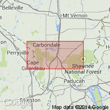
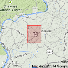
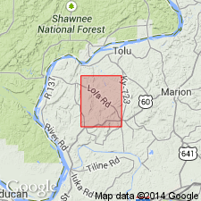
- Areal extent
- Overview
- AAPG geologic province:
-
- Illinois basin
Summary:
Current (1986) usage of Indiana Geological Survey is Degonia Sandstone of Buffalo Wallow Group. "The Degonia Sandstone, now restricted to subsurface use, is uncertainly known from Perry County westward to Posey County and thence northward to Gibson. Reliable lithologic and thickness data are not available." Overlies Clore Limestone; underlies Kinkaid Limestone.
Source: GNU records (USGS DDS-6; Reston GNULEX).
- Usage in publication:
-
- Degonia Formation
- Modifications:
-
- Revised
- AAPG geologic province:
-
- Illinois basin
Summary:
The Pope Group, here revised from Megagroup and apparently reinstated, comprises strata from the base of the Aux Vases Sandstone to the top of the Kinkaid Formation, which includes the Degonia Formation. According to authors, "The Pope Group is a lithostratigraphic unit distinct from its chronostratigraphic counterpart, the Chesterian Series." The lower boundaries of the two differ slightly. The group is about 1,425 ft thick in the Waltersburg quad, but the lowermost formations, from the Aux Vases Sandstone up to the Fraileys Shale Member of the Golconda Formation do not crop out. This interval is 384 ft thick in the Austin Roberts No. 1 Well. [See subunit list in index portion of Pope summary record. Publication does not name the units between the Aux Vases and the Fraileys and therefore these have not been included in the list.]
Source: GNU records (USGS DDS-6; Reston GNULEX).
For more information, please contact Nancy Stamm, Geologic Names Committee Secretary.
Asterisk (*) indicates published by U.S. Geological Survey authors.
"No current usage" (†) implies that a name has been abandoned or has fallen into disuse. Former usage and, if known, replacement name given in parentheses ( ).
Slash (/) indicates name conflicts with nomenclatural guidelines (CSN, 1933; ACSN, 1961, 1970; NACSN, 1983, 2005, 2021). May be explained within brackets ([ ]).