

- Usage in publication:
-
- Deese member
- Modifications:
-
- Original reference
- Dominant lithology:
-
- Sandstone
- Conglomerate
- Shale
- AAPG geologic province:
-
- South Oklahoma folded belt
Summary:
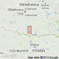
Deese member of Glenn formation. Characterized by a large number of massive sandstones, conglomerates, shales, and a few limestones. To north of Ardmore the base is marked by a brown limestone bearing an abundance of SPIRIFER CONDOR; south of Ardmore this horizon is represented by a bed of chert, and there is a thick conglomerate at base. Occurs in northwest-southeast exposure just east of Deese, [Carter County, central southern Oklahoma]. Thickness 6,000 to 8,000 feet. Underlies Hoxbar member and overlies Cup Coral member. Fossils listed (brachiopods, bryozoans, bivalves). [Age is Pennsylvanian.]
Source: US geologic names lexicon (USGS Bull. 896, p. 589-590).
- Usage in publication:
-
- Deese formation
- Modifications:
-
- Revised
- AAPG geologic province:
-
- South Oklahoma folded belt
Summary:
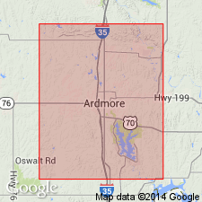
Raised in rank to formation. Was formerly included as a member of the Glenn formation (Goldston, 1922). Two members named--Devil's Kitchen member lies 500 to 800 ft above base of formation; Arnold member lies about 3,300 ft below top of Deese. Type locality designated in sec 33, T3S, R1E, Carter Co, OK in the S. Oklahoma folded belt province. Overlies Pumpkin Creek member (new) of the Dornick Hills formation (new); underlies Confederate limestone member (new) of the Hoxbar formation. Is about 7000 ft thick in Love Co; about 6000 ft thick northwest of the town of Ardmore. Geologic maps; columnar sections; fossil lists (crinoids, endothyrids, brachiopods, mollusks). Of Pennsylvanian age.
Source: GNU records (USGS DDS-6; Denver GNULEX).
For more information, please contact Nancy Stamm, Geologic Names Committee Secretary.
Asterisk (*) indicates published by U.S. Geological Survey authors.
"No current usage" (†) implies that a name has been abandoned or has fallen into disuse. Former usage and, if known, replacement name given in parentheses ( ).
Slash (/) indicates name conflicts with nomenclatural guidelines (CSN, 1933; ACSN, 1961, 1970; NACSN, 1983, 2005, 2021). May be explained within brackets ([ ]).