The National Geologic Map Database is migrating to a new infrastructure. We apologize for any service disruptions during this process.
|
|---|


- Usage in publication:
-
- Deerfield diabase*
- Modifications:
-
- Named
- Dominant lithology:
-
- Diabase
- AAPG geologic province:
-
- New England province
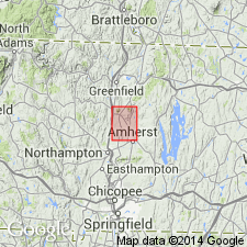
- Deerfield basin
Summary:
The diabase sheet which overlies the Mount Toby Conglomerate at its north and south ends and Longmeadow Sandstone and Chicopee Shale in the middle is named the Deerfield Diabase bed. Age is Late Triassic.
Source: GNU records (USGS DDS-6; Reston GNULEX).
- Usage in publication:
-
- Deerfield trap*
- Modifications:
-
- Areal extent
- Dominant lithology:
-
- Trap
- AAPG geologic province:
-
- Deerfield basin
- New England province
Summary:
The Deerfield sheet, a bed of trap similar to the main sheet of the Holyoke Diabase, is a vesicular, fine-grained, dark trap. It occurs north of the Holyoke quad. In Sunderland and Deerfield, where it rests on Mount Toby Conglomerate, extends across the Connecticut River on the Sugarloaf Arkose, and forms the core of Deerfield Mountain.
Source: GNU records (USGS DDS-6; Reston GNULEX).
- Usage in publication:
-
- Deerfield diabase*
- Modifications:
-
- Revised
- AAPG geologic province:
-
- Deerfield basin
- New England province
Summary:
The Deerfield trap is here removed from the Holyoke diabase and is revised as the Deerfield diabase. It consists of fine-grained black diabase and is exposed on the west and south slopes of Mount Toby and west of the Connecticut River in the Pocumtuck Range. There is no evidence that the Deerfield and Holyoke diabases came from a common conduit or were contemporaneous. Overlies Sugarloaf formation; underlies Turners Falls sandstone. Age is Late Triassic.
Source: GNU records (USGS DDS-6; Reston GNULEX).

- Usage in publication:
-
- Deerfield Basalt*
- Modifications:
-
- Overview
- AAPG geologic province:
-
- Deerfield basin
- New England province
Summary:
Used as Deerfield Basalt of Early Jurassic age. [No explanation given for name change.]
Source: GNU records (USGS DDS-6; Reston GNULEX).
- Usage in publication:
-
- Deerfield Basalt
- Modifications:
-
- Biostratigraphic dating
- AAPG geologic province:
-
- Deerfield basin
- New England province
Summary:
The Deerfield Basalt is a single flow of tholeiitic basalt. Age is Early Jurassic, based on the presence of Jurassic palynoflorules in the uppermost Sugarloaf Formation, which underlies the Deerfield, and on K-Ar dates.
Source: GNU records (USGS DDS-6; Reston GNULEX).
- Usage in publication:
-
- Deerfield Basalt*
- Modifications:
-
- Revised
- Redescribed
- Dominant lithology:
-
- Basalt
- AAPG geologic province:
-
- New England province
- Deerfield basin
Summary:
The Deerfield Diabase is here redefined as Deerfield Basalt of the Newark Supergroup to reflect its extrusive origin, shown by pillows and pillow breccias at the base, and by vesicular pahoehoe flows at the top. The Triassic-Jurassic boundary is arbitrarily drawn at the base of the Deerfield in clastic rocks of the Sugarloaf Formation.
Source: GNU records (USGS DDS-6; Reston GNULEX).
For more information, please contact Nancy Stamm, Geologic Names Committee Secretary.
Asterisk (*) indicates published by U.S. Geological Survey authors.
"No current usage" (†) implies that a name has been abandoned or has fallen into disuse. Former usage and, if known, replacement name given in parentheses ( ).
Slash (/) indicates name conflicts with nomenclatural guidelines (CSN, 1933; ACSN, 1961, 1970; NACSN, 1983, 2005, 2021). May be explained within brackets ([ ]).