The National Geologic Map Database is migrating to a new infrastructure. We apologize for any service disruptions during this process.
|
|---|


- Usage in publication:
-
- "Deer Valley" formation
- Modifications:
-
- Original reference
- Dominant lithology:
-
- Sandstone
- AAPG geologic province:
-
- Sacramento basin
Summary:
Pg. 17-19, corr. chart, pl. 3, geol. map. "Deer Valley" formation. A prominent ridge-forming coarse-grained sandstone that caps "Marsh Creek" formation (new). Thickness 500 feet at Oil Canyon. Between Oil Canyon and Kellogg Creek to south thickens to 800 feet. Thins to less than 50 feet northwest of Oil Canyon and is eventually truncated by fault near Nortonville-Clayton road. Gradational contact separates cliff-forming sandstones from chocolate mudstones of underlying "Marsh Creek" formation. Contact drawn in stratigraphic interval of 15 feet where light-gray sandstones begin to predominate. Concordantly overlain by "Martinez" formation in Oil Canyon area. Between Oil Canyon and Deer Valley Road, Meganos formation overlaps the "Martinez" and rests on the "Deer Valley". Age is Late Cretaceous (Maastrichtian).
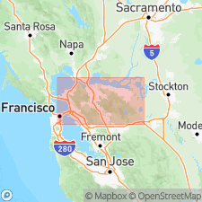
Type section: exposures on north wall of Oil Canyon between point at base of formation, 650 ft W. and 2,000 ft S. of NE cor. sec. 15, T. 1 N., R 1 E., and point at top of formation, 650 ft W. and 1,800 ft S. of NE cor. sec. 15, T. 1 N., R. 1 E., Contra Costa Co., northern CA. Formation exposed only on north flank of Mount Diablo on ridge separating Briones Valley from Deer Valley.
Source: US geologic names lexicon (USGS Bull. 1350, p. 199-200); GNC index card files (USGS-Menlo).
For more information, please contact Nancy Stamm, Geologic Names Committee Secretary.
Asterisk (*) indicates published by U.S. Geological Survey authors.
"No current usage" (†) implies that a name has been abandoned or has fallen into disuse. Former usage and, if known, replacement name given in parentheses ( ).
Slash (/) indicates name conflicts with nomenclatural guidelines (CSN, 1933; ACSN, 1961, 1970; NACSN, 1983, 2005, 2021). May be explained within brackets ([ ]).