

- Usage in publication:
-
- Deer Valley Limestone Member
- Modifications:
-
- Overview
- Dominant lithology:
-
- Limestone
- Oolite
- AAPG geologic province:
-
- Appalachian basin
Summary:
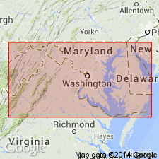
Greenbrier Formation is here revised in western MD to include (ascending) Loyalhanna, Deer Valley, Savage Dam (new name), and Wymps Gap Members. In the study area, the medium-bedded, pure limestones of the Deer Valley contrast with the cross-bedded sandy limestones of the underlying Loyalhanna. Carbonate strata within the Deer Valley are typically light-gray to gray-green, locally variegated, very dense well-cemented lime grainstone composed of ooids, intraclasts, micrite-coated grains, and grapestone aggregates. Locally upper 3 ft composed of well-developed oolite. Unit thins from south to north. Maximum thickness of 20 ft occurs in southern Garrett Co. Unit pinches out in southern Somerset Co., PA.
Source: GNU records (USGS DDS-6; Reston GNULEX).

- Usage in publication:
-
- Deer Valley Limestone Member*
- Modifications:
-
- Biostratigraphic dating
- AAPG geologic province:
-
- Appalachian basin
Summary:
A Chesterian age is suggested for the Deer Valley Limestone Member of the Greenbrier Limestone. Conodonts indicative of Chesterian faunas were recovered from the underlying Loyalhanna Limestone Member and the Overlying Wymps Gap Member.
Source: GNU records (USGS DDS-6; Reston GNULEX).
For more information, please contact Nancy Stamm, Geologic Names Committee Secretary.
Asterisk (*) indicates published by U.S. Geological Survey authors.
"No current usage" (†) implies that a name has been abandoned or has fallen into disuse. Former usage and, if known, replacement name given in parentheses ( ).
Slash (/) indicates name conflicts with nomenclatural guidelines (CSN, 1933; ACSN, 1961, 1970; NACSN, 1983, 2005, 2021). May be explained within brackets ([ ]).