The National Geologic Map Database is migrating to a new infrastructure. We apologize for any service disruptions during this process.
|
|---|


- Usage in publication:
-
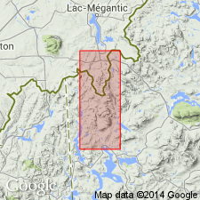
- Deer Mountain Member*
- Modifications:
-
- Named
- Dominant lithology:
-
- Greenstone
- Phyllite
- Slate
- Quartzite
- AAPG geologic province:
-
- New England province
Summary:
Named for Deer Mountain, Oxford Co., western ME. Named as a member of the Albee Formation. Type area is on north slope and northeast-trending ridge of Deer Mountain. Exposures are scattered throughout southern part of Cupsuptic 15-min quad. Consists of green slate and phyllite that contain thin stringers of quartz and less than 10 percent feldspathic quartzite; includes lenticular units of black phyllite at base, purplish-gray and green phyllite at top, and minor greenstone. Thickness is 2,500 ft in type area but wedges out completely to the north and northwest. Lower contact with Portage Brook Member is sharp and conformable; upper contact with unnamed rocks is marked by alternating layers of green phyllite and greenstone through a 300-ft-thick zone. Report includes geologic map. Age is Early and Middle Ordovician.
Source: GNU records (USGS DDS-6; Reston GNULEX).
For more information, please contact Nancy Stamm, Geologic Names Committee Secretary.
Asterisk (*) indicates published by U.S. Geological Survey authors.
"No current usage" (†) implies that a name has been abandoned or has fallen into disuse. Former usage and, if known, replacement name given in parentheses ( ).
Slash (/) indicates name conflicts with nomenclatural guidelines (CSN, 1933; ACSN, 1961, 1970; NACSN, 1983, 2005, 2021). May be explained within brackets ([ ]).