

- Usage in publication:
-
- Deer Butte Formation
- Modifications:
-
- Areal extent
- Biostratigraphic dating
- AAPG geologic province:
-
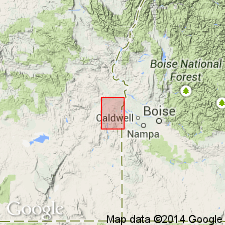
- Snake River basin
Summary:
Deer Butte Formation. Contains section of fine-grained tuffaceous sedimentary rocks with few intercalated basalt flows (shown separately) in lower part, grading upward into massive sandstones and conglomerates. Thickness at Deer Butte 1,248 feet. Deer Butte beds in southwest corner of Mitchell Butte 30-min quadrangle [this report] have been repeated several times by block faulting. Near mouth of Dry Creek disconformably overlies Owyhee Basalt; farther south overlies Sucker Creek Formation; unconformably underlies Kern Basin Formation (new). Fossil leaves, bones, and fresh water mollusks have been found in lower member, and mollusks also in upper member. Age is late Miocene (Barstovian) based on fossils (Johnson, 1961).
Source: US geologic names lexicon (USGS Bull. 1350, p. 199); supplemental information from GNU records (USGS DDS-6; Menlo GNULEX).
- Usage in publication:
-
- Deer Butte formation
- Modifications:
-
- Original reference
- Dominant lithology:
-
- Volcaniclastics
- Basalt
- AAPG geologic province:
-
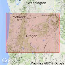
- Snake River basin
Summary:
Pg. 4321. Deer Butte formation. Contains mixed pyroclastic and detrital sedimentary rocks and at least two extensive units of olivine basalt. Divided locally into seven members. Thickness at least 3,000 feet. Overlies Owyhee basalt; unconformably underlies Grassy Mountain formation. Age is late Miocene and early(?) Pliocene based on fossils [mammalian fauna].
Source: US geologic names lexicon (USGS Bull. 1350, p. 199); supplemental information from GNU records (USGS DDS-6; Menlo GNULEX).
- Usage in publication:
-
- Deer Butte Formation
- Modifications:
-
- Principal reference
- Dominant lithology:
-
- Volcaniclastics
- Basalt
- Sandstone
- Conglomerate
- AAPG geologic province:
-
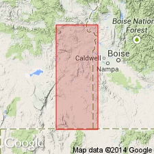
- Snake River basin
Summary:
Pg. 5 (fig. 4), 8-10, 36-38. Deer Butte Formation. Formal proposal of name. Name given to an assemblage of altered volcaniclastic rocks, extrusive basalts, arkose sandstones, and granite-cobble conglomerates exposed at Deer Butte. Unconformably overlies Owyhee Basalt; unconformably underlies Grassy Mountain Formation. Thickness 950 feet at type; at least 2,000 feet exposed locally; aggregate thickness may be 3,000 feet. Subdivided into (ascending): Red Butte, Orlano Spring, Holdout, Quartz Mountain Basalt, Burnt Mountain, Sourdough Basin Basalt, and Mitchell Butte Members (all new). Part of the Deer Butte may be laterally contiguous with strata of Poison Creek Formation of Buwalda (1923) along western margin of Snake River Plain. Deer Butte is part of Idaho Group defined by Malde and Powers (1962). Major part is assigned Barstovian on basis of mammalian fauna. Upper part is probably early Pliocene based on stratigraphic relations with Poison Creek Formation. Type [section] designated.
Type [section]: measured at Deer Butte, in E/2 sec. 21, T. 21 S., R. 45 E., Malheur Co., eastern OR.
Source: US geologic names lexicon (USGS Bull. 1350, p. 199); supplemental information from GNU records (USGS DDS-6; Menlo GNULEX).
- Usage in publication:
-
- Deer Butte Formation
- Modifications:
-
- Geochronologic dating
- AAPG geologic province:
-
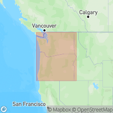
- Snake River basin
Summary:
Deer Butte Formation. Sample from volcanic sandstone in Holdout Member of Deer Butte Formation, collected on northeast side of Quartz Mountain, in SW/4 sec. 23, T. 24 S., R. 43 E., Mitchell Butte 30-min quadrangle, Malheur County, Oregon. K-Ar age on sanidine 19.7 +/-1.0 Ma.
Source: Modified from GNU records (USGS DDS-6; Menlo GNULEX).
For more information, please contact Nancy Stamm, Geologic Names Committee Secretary.
Asterisk (*) indicates published by U.S. Geological Survey authors.
"No current usage" (†) implies that a name has been abandoned or has fallen into disuse. Former usage and, if known, replacement name given in parentheses ( ).
Slash (/) indicates name conflicts with nomenclatural guidelines (CSN, 1933; ACSN, 1961, 1970; NACSN, 1983, 2005, 2021). May be explained within brackets ([ ]).