

- Usage in publication:
-
- Deep Creek sandstone
- Modifications:
-
- Original reference
- Dominant lithology:
-
- Sandstone
- AAPG geologic province:
-
- Green River basin
Summary:
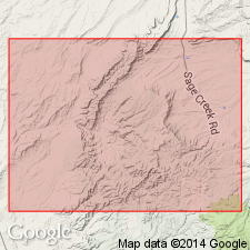
Pg. 130, 131 (fig. 1), 132 (fig. 2). Deep Creek sandstone. Basal sandstone of Mesaverde. Thickness 30 to 50 feet. A well-developed fine- to medium-grained sandstone in wells and on outcrop froms prominent escarpment. Correlated over wide area in subsurface and on outcrop, but eastward from subject area [eastern Washakie basin] it is split by shale tongue Espy (new) and eventually disappears in Steele shale. Age is Late Cretaceous (Campanian).
Well developed in subsurface, Amerada Petroleum Corp. Deep Creek Unit Well No. 1, in sec. 30, T. 16 N., R. 90 W., Carbon Co., south-central WY.
Source: US geologic names lexicon (USGS Bull. 1350, p. 197-198); supplemental information from GNU records (USGS DDS-6; Denver GNULEX).
- Usage in publication:
-
- Deep Creek Sandstone Member*
- Modifications:
-
- Revised
- AAPG geologic province:
-
- Green River basin
Summary:
Assigned a formal stratigraphic rank. Reassigned as lower member of Haystack Mountains Formation of Mesaverde Group at Point of Rocks, T22N, R88W, Sweetwater Co, WY, Greater Green River basin. Occurs south to Wild Cow Creek, Carbon Co, WY. Overlies Steele Shale. Underlies Espy Tongue (adopted) of Steele Shale. Of Late Cretaceous, Campanian age.
Source: GNU records (USGS DDS-6; Denver GNULEX).
For more information, please contact Nancy Stamm, Geologic Names Committee Secretary.
Asterisk (*) indicates published by U.S. Geological Survey authors.
"No current usage" (†) implies that a name has been abandoned or has fallen into disuse. Former usage and, if known, replacement name given in parentheses ( ).
Slash (/) indicates name conflicts with nomenclatural guidelines (CSN, 1933; ACSN, 1961, 1970; NACSN, 1983, 2005, 2021). May be explained within brackets ([ ]).