

- Usage in publication:
-
- Deep Creek basalt
- Modifications:
-
- First used
- Dominant lithology:
-
- Basalt
- AAPG geologic province:
-
- Yellowstone province
Summary:
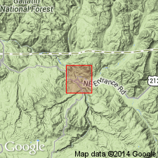
First published use. Neither intent to name nor type locality designated. Largest exposure is on west side Yellowstone Canyon, up from Tower Creek, half a mi above Deep Creek, northern Yellowstone National Park, WY in Yellowstone province. Detailed lithologic description not given. Formed thick columns that average 3 ft diameter at base and 12 ft in height. Three ft of scoria exposed beneath the columns. The upper part of the flow is ropy and vesicular. A cliff of brecciated rhyolite that can be massive and columnar is present above the flow. The rhyolite may be an explosion breccia. May correlate with Overhanging Cliff basalt. Age not clearly stated. [Is Miocene-Pliocene, by inference.] Geologic map.
Source: GNU records (USGS DDS-6; Denver GNULEX).
For more information, please contact Nancy Stamm, Geologic Names Committee Secretary.
Asterisk (*) indicates published by U.S. Geological Survey authors.
"No current usage" (†) implies that a name has been abandoned or has fallen into disuse. Former usage and, if known, replacement name given in parentheses ( ).
Slash (/) indicates name conflicts with nomenclatural guidelines (CSN, 1933; ACSN, 1961, 1970; NACSN, 1983, 2005, 2021). May be explained within brackets ([ ]).