- Usage in publication:
-
- Decie Formation
- Modifications:
-
- Geochronologic dating
- AAPG geologic province:
-
- Permian basin
Summary:
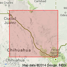
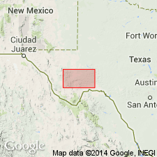
Pg. 11. Decie Formation. Rhyolite and trachyte samples from the Paisano Pass caldera, Davis Mountains area, Alpine South and Paisano quadrangles, Presidio and Brewster Counties, southwestern Texas, yielded K-Ar ages from 36.5 +/-0.8 Ma to 34.6 +/-1.4 Ma (alkali feldspar, amphibole); one sample yielded a K-Ar age of 37.8 +/-0.8 Ma (alkali feldspar) and is considered less accurate. Data from D.F. Parker, 1983 (GSA Bull., v. 94, p. 614-629), and D.F. Parker and F.W. McDowell, 1979 (GSA Bull., v. 90, p. 1100-1110); ages recalculated using decay constants of Steiger and Jager, 1977 (Earth Planet. Sci. Letters, v. 36, p. 359-362).
[Age considered Eocene to Oligocene; Eocene-Oligocene boundary 36.6 (38-34) Ma (from Geologic Names Committee, USGS, 1983 ed. geol. time scale, with additions from N.J. Snelling, 1985, The Geol. Soc. Mem., no. 10).]
Source: Publication.

- Usage in publication:
-
- Decie Member
- Modifications:
-
- Mapped 1:250k
- Dominant lithology:
-
- Volcanics
- AAPG geologic province:
-
- Permian basin
Summary:
Decie Member of Duff Formation (Map unit Tdd). Comprises volcanic materials from Paisano volcano forming 5 units listed from youngest to oldest as follows:
1. Variety of lava types, minor agglomeratic tuff, conglomerate, and ash-flow tuff, reddish-gray, weathers dark brown;
2. Ash-flow tuff with mm-size alkali feldspar phenocrysts, pink to pinkish-gray;
3. Aphyric to slightly porphyritic quartz trachyte with 1 to 2 mm-[sized] alklali feldspar phenocrysts, dark gray, weathers dark brown, platy fracture;
4. Yellow agglomeratic tuff interlayered with 2 minor quartz trachyte ash-flow sheets, upper one dark brown, lower one light brown to reddish-brown, weathers orange to red-brown;
5. Rhyolite lava including spotted aphyric peralkaline rhyolite with minor agglomerate, bedded tuff, and punky ash-flow tuff.
The above 5 units form a jumbled collapsed terrain (map unit ct), marking a caldera 4 miles across in vicinity of Paisano Siding. Aggregate thickness of Decie Member about 3,000 feet, wedges out southeastward near Haley Ranch north of Cathedral Mountain and northward near Mitre Peak; K-Ar age, 35.3 +/- m.y. (4 samples).
Source: Publication.
For more information, please contact Nancy Stamm, Geologic Names Committee Secretary.
Asterisk (*) indicates published by U.S. Geological Survey authors.
"No current usage" (†) implies that a name has been abandoned or has fallen into disuse. Former usage and, if known, replacement name given in parentheses ( ).
Slash (/) indicates name conflicts with nomenclatural guidelines (CSN, 1933; ACSN, 1961, 1970; NACSN, 1983, 2005, 2021). May be explained within brackets ([ ]).

