

- Usage in publication:
-
- Deal Member
- Modifications:
-
- Named
- Biostratigraphic dating
- Dominant lithology:
-
- Sand
- Silt
- Clay
- AAPG geologic province:
-
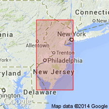
- Atlantic Coast basin
Summary:
The upper member of the Manasquan Formation (ash marl of Cook, 1868) is herein designated the Deal Member for the good exposures in the vicinity of the Borough of Deal, Monmouth Co, NJ. The Deal Member is the dominant Manasquan lithology in the subsurface. It ranges from very slightly glauconitic, clayey, fine-grained, quartz sand to a clayey, sandy silt. Downdip the unit ranges from a slightly sandy, clayey silt to a silty clay. The unit is finely laminated and contains scattered cristobalitic nodules, which in many cases are porcelanite. Thickness of this unit ranges from approximately 40 ft near outcrop to about 140 ft in the Toms River area. Member grades into the underlying Farmingdale Member and the overlying Squankum Member of the Shark River Formation. As the Farmingdale and Squankum become more clayey and less glauconitic downdip, they are replaced by the Deal. Upper and lower boundaries of the Deal are placed where coarse glauconite sand grains appear in more than trace amounts. An extensive, well preserved microfauna is contained in the Deal Member well samples. The enclosed planktonic foraminiferal fauna indicates that deposition of this member spanned the early early Eocene to the earliest middle Eocene.
Source: GNU records (USGS DDS-6; Reston GNULEX).
For more information, please contact Nancy Stamm, Geologic Names Committee Secretary.
Asterisk (*) indicates published by U.S. Geological Survey authors.
"No current usage" (†) implies that a name has been abandoned or has fallen into disuse. Former usage and, if known, replacement name given in parentheses ( ).
Slash (/) indicates name conflicts with nomenclatural guidelines (CSN, 1933; ACSN, 1961, 1970; NACSN, 1983, 2005, 2021). May be explained within brackets ([ ]).