The National Geologic Map Database is migrating to a new infrastructure. We apologize for any service disruptions during this process.
|
|---|


- Usage in publication:
-
- Deadman limestone*
- Modifications:
-
- Areal extent
- AAPG geologic province:
-
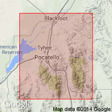
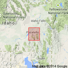
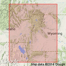
- Snake River basin
Summary:
Pg. 492. Deadman limestone, 150 feet thick. A member of Nugget sandstone of Fort Hall Indian Reservation. Overlies Higham grit and underlies Wood shale.
Source: US geologic names lexicon (USGS Bull. 896, p. 577).
- Usage in publication:
-
- Deadman limestone member*
- Modifications:
-
- Principal reference
- Dominant lithology:
-
- Limestone
- Chert
- AAPG geologic province:
-
- Snake River basin
Summary:
Pg. 32, 41. Deadman limestone member of Nugget sandstone. Dense purplish-gray limestone of almost lithographic quality, with subordinate amounts of gray and greenish chert. Thickness 150+/- feet. Overlies Higham grit member of Nugget and underlies Wood shale member of Nugget. No fossils. [Age is Triassic(?).]
Named from Deadman Creek, in northeast part of T. 4 S., R. 38 E., Boise meridian, in northeast part of Fort Hall Indian Reservation, Bingham Co., southeastern ID, near headwaters of which it is exposed.
Source: US geologic names lexicon (USGS Bull. 896, p. 577).
- Usage in publication:
-
- Deadman limestone*
- Modifications:
-
- Revised
- Adopted
- AAPG geologic province:
-
- Snake River basin
Summary:
Pg. 29, 52. Treated Deadman limestone, Wood shale, and Higham grit as distinct formations, and restricted Nugget sandstone to upper part ("main sandstone member") of Nugget sandstone as recognized by him in previous reports. This is present [ca. 1938] generally accepted definition. Age is Triassic(?). Report includes geologic map, stratigraphic table, history of nomenclature chart.
Source: US geologic names lexicon (USGS Bull. 896, p. 577); supplemental information from GNU records (USGS DDS-6; Denver GNULEX).
- Usage in publication:
-
- Deadman limestone
- Modifications:
-
- Overview
Summary:
Pg. 1801 (table 1). Deadman limestone. Age shown on table as Upper(?) Triassic.
Source: US geologic names lexicon (USGS Bull. 1200, p. 1056).
- Usage in publication:
-
- Deadman limestone*
- Modifications:
-
- Principal reference
- AAPG geologic province:
-
- Snake River basin
Summary:
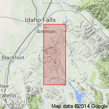
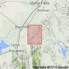
Pg. 17, 34-35, pl. 1. Deadman limestone. Mapped in Ammon and Paradise Valley quadrangles. Thickness about 150 feet. Overlies Higham grit and underlies Wood shale. Age is Triassic(?). Type locality designated.
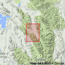
Type locality: Deadman Creek in northeastern part of T. 4 S., R. 38 E., Paradise Valley quadrangle, ID, where formation is crossed by the creek and extends northwestward along the ridge parallel to and northeast of prominent band of Higham grit. Named from Deadman Creek.
Source: US geologic names lexicon (USGS Bull. 1200, p. 1056); supplemental information from GNU records (USGS DDS-6; Denver GNULEX).
- Usage in publication:
-
- Deadman limestone*
- Modifications:
-
- Areal extent
- AAPG geologic province:
-
- Snake River basin
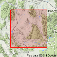
- Wasatch uplift
Summary:
Pg. 180-181. Mansfield (1927, USGS Prof. Paper 152) recognized following sequence of beds between Thaynes and Nugget formations; Timothy sandstone, Higham grit, Deadman limestone, and Wood shale. These units are distinct lithologically and are equivalent to Ankareh formation of Wasatch and Uinta Mountains of western Wyoming. In present report, Timothy sandstone is considered uppermost member of Thaynes. Higham grit and Deadman limestone are recognized as independent formations and Wood shale is considered westward extending tongue of Ankareh formation. At type area, the Deadman is 150 feet thick and directly overlies Higham grit. [Age is Late Triassic.]
Source: US geologic names lexicon (USGS Bull. 1200, p. 1056).
- Usage in publication:
-
- Deadman limestone*
- Modifications:
-
- Areal extent
- AAPG geologic province:
-
- Yellowstone province
Summary:
Pg. 46. Deadman limestone. Geographically extended into Snake River Range, Wyoming. [Age is Late Triassic.]
Source: US geologic names lexicon (USGS Bull. 1200, p. 1056).
- Usage in publication:
-
- Deadman Limestone*
- Modifications:
-
- Mapped
- AAPG geologic province:
-
- Wasatch uplift
Summary:
Deadman Limestone. Consists of (ascending): (1) red-brown, gray, purple, and buff sandstone and siltstone with a few thin limestone beds; (2) gray, commonly mottled green, red, purple crystalline limestone containing gray and pale green chert nodules; and (3) red, brown to red-gray calcareous shale and siltstone with some thin lithographic gray limestone beds in upper part. Thickness about 280 feet. Occurs above Higham Grit and below Wood Shale Tongue of Ankareh Formation. Age is Late Triassic.
Source: Modified from GNU records (USGS DDS-6; Denver GNULEX).
- Usage in publication:
-
- Deadman Limestone*
- Modifications:
-
- Mapped
- AAPG geologic province:
-
- Snake River basin
Summary:
Name applied to a 150 ft thick white, pink-, green-, to purple-gray, dense limestone. Contains minor chert. Overlies Higham Grit. Underlies Wood Shale. Mapped as a thin band in east-central part of quad. in Bingham Co., ID in the Snake River basin. Assigned to the Upper Triassic.
Source: GNU records (USGS DDS-6; Denver GNULEX).
For more information, please contact Nancy Stamm, Geologic Names Committee Secretary.
Asterisk (*) indicates published by U.S. Geological Survey authors.
"No current usage" (†) implies that a name has been abandoned or has fallen into disuse. Former usage and, if known, replacement name given in parentheses ( ).
Slash (/) indicates name conflicts with nomenclatural guidelines (CSN, 1933; ACSN, 1961, 1970; NACSN, 1983, 2005, 2021). May be explained within brackets ([ ]).