

- Usage in publication:
-
- DeNay limestone member
- Modifications:
-
- Original reference
- Dominant lithology:
-
- Limestone
- AAPG geologic province:
-
- Chautauqua platform
- Arkoma basin
Summary:
Pg. 110-115; 1922, Oklahoma Geol. Survey Circ., no. 12, p. 9, 10. Denay limestone member. Basal member of Francis formation. In region north of Canadian River the bed is rather dense and breaks out in elongated blocks. In road about 0.5 mile east of Francis the bed is slightly crinoidal. In region south of Ada the bed is almost wholly composed of crinoids. In northeastern part of T. 3 N., R. 5 E., [Pontotoc County, Oklahoma], the crinoids become less abundant and the limestone develops a bright yellow color. Average thickness a little more than 1 foot. Is overlain by 30+/- feet of dark blue and black shales. Underlain by Seminole conglomerate. Age is Pennsylvanian. Report includes fossil list (Francis fauna), geologic map.
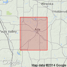
Named for typical development on side of an eastward-facing bluff in sec. 5, T. 4 N., R. 7 E., Pontotoc Co., OK, about 0.25 mi east of DeNay School, in Stonewall quadrangle, Pontotoc Co., OK.
Source: US geologic names lexicon (USGS Bull. 896, p. 596); GNC OK Corr. Chart, sheet 2, Jan. 1931; supplemental information from GNU records (USGS DDS-6; Denver GNULEX).
- Usage in publication:
-
- DeNay limestone member
- Modifications:
-
- Revised
- AAPG geologic province:
-
- Chautauqua platform
- Arkoma basin
Summary:
Pg. 62, 63, 64. Reallocated to member status in Coffeyville formation. Interval designated by Morgan (1924) as Francis formation is herein described under headings Coffeyville and Nellie Bly. Age is Late Pennsylvanian (Missourian).
Source: US geologic names lexicon (USGS Bull. 1200, p. 1088).
For more information, please contact Nancy Stamm, Geologic Names Committee Secretary.
Asterisk (*) indicates published by U.S. Geological Survey authors.
"No current usage" (†) implies that a name has been abandoned or has fallen into disuse. Former usage and, if known, replacement name given in parentheses ( ).
Slash (/) indicates name conflicts with nomenclatural guidelines (CSN, 1933; ACSN, 1961, 1970; NACSN, 1983, 2005, 2021). May be explained within brackets ([ ]).