The National Geologic Map Database is migrating to a new infrastructure. We apologize for any service disruptions during this process.
|
|---|


- Usage in publication:
-
- DeChelly sandstone
- Modifications:
-
- Adopted
- AAPG geologic province:
-
- Black Mesa basin
- Paradox basin
Summary:
Pg. 102. DeChelly sandstone. Name adopted for forthcoming report for beds overlying Moenkopi formation and underlying Shinarump conglomerate in Navajo Indian Reservation, Arizona. [Not described.]
Source: US geologic names lexicon (USGS Bull. 896, p. 581-582).
- Usage in publication:
-
- DeChelly sandstone*
- Modifications:
-
- Mapped
- Dominant lithology:
-
- Sandstone
- AAPG geologic province:
-
- Black Mesa basin
- Paradox basin
Summary:
Pg. 31+, pl. 2; USGS Water-Supply Paper 380, 1916. DeChelly sandstone. Massive, very cross-bedded light-red or brown sandstone, 0 to 585 feet thick, unconformably underlying Shinarump conglomerate and overlying Moenkopi formation in Navajo country. Age is Permian(?).
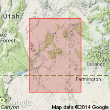
Mapped along Canyon de Chelly, Apache Co., northeastern AZ.
Source: Publication; US geologic names lexicon (USGS Bull. 896, p. 581-582).
- Usage in publication:
-
- DeChelly sandstone member*
- Modifications:
-
- Revised
- AAPG geologic province:
-
- Black Mesa basin
- Paradox basin
Summary:
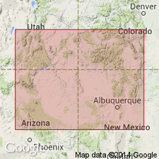
Pg. 1424-1448. DeChelly sandstone member of Cutler formation. After considerable field work in southeastern Colorado, northeastern New Mexico, southeastern Utah, and northeastern Arizona, made the following changes in nomenclature of southeastern Utah and northeastern Arizona: (1) they identified all red beds (including 2 conspicuous light-colored sandstones) between base of Shinarump conglomerate and above top of "Goodridge formation." as belonging to Cutler formation; (2) they divided the "Goodridge" into Rico formation and Hermosa formation; (3) they divided the Cutler of southeastern Utah and northeastern Arizona into (descending) Hoskinini tongue (red). DeChelly sandstone member (light-colored), Organ Rock tongue (red), Cedar Mesa sandstone member (white), and Halgaito tongue (red); (4) they restricted the name DeChelly sandstone in Utah to southern part of San Juan County and applied the new name White Rim sandstone member to the 0 to 100 feet of white sandstone, in northern part of San Juan County, of approximately the same age as upper part of typical DeChelly and called DeChelly and DeChelly(?) in previous reports. "Northeast from Monument Valley the DeChelly sandstone thins out and disappears near San Juan River at Clay Hill Crossing, and the upper and middle red beds merge." "In walls of Canyon De Chelly an incomplete exposure of DeChelly member shows a thickness of 800+ feet." This is present approved nomenclature of southeastern Utah and northeastern Arizona. [Age is Permian.]
Source: US geologic names lexicon (USGS Bull. 896, p. 581-582).
- Usage in publication:
-
- De Chelly sandstone
- Modifications:
-
- Revised
- AAPG geologic province:
-
- San Juan basin
Summary:
Pg. 90. De Chelly sandstone. Rank raised to formation. Eolian De Chelly grades into continental fluvial deposits overlying differentiated Cutler in southeastern Utah; along northeast margin of southern and western San Juan basin, loses its identity as it grades into arkosic facies of Cutler. In Arizona, overlies Supai formation; in New Mexico, overlies Yeso formation along its lateral boundary with the Glorieta. Includes Hoskinnini as member. [Age is Permian.]
Source: US geologic names lexicon (USGS Bull. 1200, p. 1063).
- Usage in publication:
-
- De Chelly member
- AAPG geologic province:
-
- Black Mesa basin
- Paradox basin
Summary:
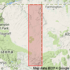
Pg. 1855 (fig. 2), 1857 (fig. 3), 1862. De Chelly member of Cutler formation. In and near Monument Valley, De Chelly member of Cutler underlies Hoskinnini (herein reallocated to member status in Moenkopi formation). Thickness about 300 feet. [Age is Permian.]
Source: US geologic names lexicon (USGS Bull. 1200, p. 1063).
- Usage in publication:
-
- De Chelly Sandstone
- Modifications:
-
- Areal extent
- AAPG geologic province:
-
- San Juan basin
Summary:
Sandstones named Meseta Blanca Sandstone Member of the Yeso Formation in the Nacimiento Mountains north of Albuquerque, NM, Sandoval Co, San Juan basin, are equivalent to Permian De Chelly Sandstone of the Cutler Group in Zuni Mountains and Defiance uplift, McKinley and Valencia Cos, San Juan basin. The De Chelly and the Meseta Blanca are flat-bedded and thinly bedded siltstone or very fine sandstones that were deposited in a subaqueous and probably marine environment. Term De Chelly has precedence over Meseta Blanca. Regional use of one name will clarify relationship of the De Chelly and the Yeso. Cross sections. [Author suggests preference for De Chelly, but does not abandon Meseta Blanca.] Yeso treated as a unit restricted by removal of De Chelly-type sandstones from it. Isopach map. Cross sections. Nomenclature chart. Overlies Supai at Mogollon Rim, Abo in central NM, and Organ Rock Shale of Cutler Group in the Four Corners area. Underlies Yeso Formation.
Source: GNU records (USGS DDS-6; Denver GNULEX).
- Usage in publication:
-
- DeChelly Sandstone
- Modifications:
-
- Revised
- AAPG geologic province:
-
- Black Mesa basin
Summary:
Lies gradationally above the Supai Formation and unconformably beneath Triassic rocks on the Defiance Plateau, Apache Co, AZ in the Black Mesa basin. Informal subdivisions--lower, middle, and upper members--replaced by (ascending): Hunters Point, Oak Springs Cliffs, White House, Black Creek, and Ft. Defiance Members, all named in this report. Cannot be correlated in its entirety with any other single Permian formation in the area. Ranges from 225 feet thick at Pine Springs to 817 feet thick in Canyon de Chelly. Considered to be a composite unit whose members can be defined on the basis of primary sedimentary structures, color, grain size, composition, cementation characteristics, and topographic expression. The name De Chelly and its members as used in this report replace use of terms such as Yeso Formation, Glorieta Sandstone, and San Andres Formation in the southern part of the Defiance Plateau. Only the Black Creek Member is present at the south end of the plateau. Permian age.
Source: GNU records (USGS DDS-6; Denver GNULEX).
- Usage in publication:
-
- De Chelly Sandstone
- Modifications:
-
- Overview
- Revised
- AAPG geologic province:
-
- Plateau sedimentary province
Summary:
Is a unit of Early Permian, Leonardian age, recognized across northeast AZ from Defiance Plateau, Black Mesa basin, to Marble Canyon of Grand Canyon in Plateau sedimentary province. Overlies Organ Rock Formation of Cutler Group. Underlies Coconino Sandstone. Grades into Schnebly Hill Formation (the newly named replacement term for Supai Formation or Group in Sedona-Oak Creek area). Considered to be an erg-margin ripple-laminated (subaqueous and eolian) to wavy-bedded sandstone. Has several types of sandstone --cross-laminated, ripple-laminated, wavy-bedded, silty. Nomenclature chart. Cross sections.
Source: GNU records (USGS DDS-6; Denver GNULEX).
For more information, please contact Nancy Stamm, Geologic Names Committee Secretary.
Asterisk (*) indicates published by U.S. Geological Survey authors.
"No current usage" (†) implies that a name has been abandoned or has fallen into disuse. Former usage and, if known, replacement name given in parentheses ( ).
Slash (/) indicates name conflicts with nomenclatural guidelines (CSN, 1933; ACSN, 1961, 1970; NACSN, 1983, 2005, 2021). May be explained within brackets ([ ]).