The National Geologic Map Database is migrating to a new infrastructure. We apologize for any service disruptions during this process.
|
|---|


- Usage in publication:
-
- Dawson arkose*
- Modifications:
-
- Named
- Dominant lithology:
-
- Sandstone
- Conglomerate
- AAPG geologic province:
-
- Denver basin
Summary:
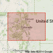
Named as lower formation of Monument Creek group in Denver basin for Dawson Butte 7 mi southwest of Castle Rock, Douglas Co, CO in Denver basin. Composed of varicolored and vari-textured conglomerate, sandstone, shale, and clay derived from rocks of Front Range and deposited under a variety of continental conditions. Sandstone which comprises greater part is a medium- to coarse-textured arkosic grit, chiefly quartz and feldspar derived from Pikes Peak granite and associated rocks. Beds and lenses of conglomerate occur throughout, but are more common in lower part and near mountains, where a basal bed is well developed, consisting of granite, quartz, quartzite, chert, and occasional fragments of limestone and sandstone, in an arkosic matrix. Local bodies of clay at Calhan of commercial importance. Pronounced irregularity in arrangement and sequence of deposits of Dawson. Cross bedding common. A number of local unconformities are exposed. Rhyolitic rocks, chiefly tuff, were extruded on an uneven surface of upper Dawson. Erosional remnants of Dawson cap a number of buttes between Castle Rock and Palmer Lake. Silicified wood, some leaves, and a few bone fragments have been found. Maximum thickness is about 2,000 ft; thicker toward mountains and thinner eastward. Unconformably overlies Laramie formation. Unconformably underlies Castle Rock conglomerate, upper formation of Monument Creek group. Of Denver and Arapahoe age; Cretaceous.
Source: GNU records (USGS DDS-6; Denver GNULEX).
- Usage in publication:
-
- Dawson arkose*
- Modifications:
-
- Revised
- AAPG geologic province:
-
- Denver basin
Summary:
Pg. 65-86. New fossil evidence places basal part of Dawson arkose and Denver formation in Upper Cretaceous sequence. Proposed that Dawson arkose be restricted to Tertiary strata and that lower part be included in redefined Laramie.
Source: US geologic names lexicon (USGS Bull. 1200, p. 1052).

- Usage in publication:
-
- Dawson Arkose*
- Modifications:
-
- Geochronologic dating
- AAPG geologic province:
-
- Denver basin
Summary:
Pg. 7, geologic time scale (inside front cover). Dawson Arkose. Samples from crystal tuffs in Watkins SE and Piney Creek 7.5-min quadrangles, Arapahoe County, Colorado, yielded K-Ar ages (biotite) of 74.3 +/-1.8 Ma (spurious) and 56.4 +/-1.4 Ma, respectively. Ages calculated using decay constants of Steiger and Jager, 1977 (Earth Planet. Sci. Letters, v. 36, p. 359-362). Latter age agrees with stratigraphic and paleontologic evidence; Soister and Tschudy (1978) reported age of 54 Ma for a volcanic tuff in Dawson Arkose. [Paleocene, based on time scale of Berggren, 1972, Lethaia, v. 5, no. 2, p. 195-215.]
Source: Publication.
- Usage in publication:
-
- Dawson Arkose
- Modifications:
-
- Overview
- Age modified
- AAPG geologic province:
-
- Denver basin
Summary:
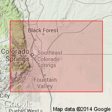
In the Air Force Academy area, El Paso Co, CO in the Denver basin, the basal Dawson is concordant with the underlying Laramie and Fox Hills Formations and dips 72 deg to 84 deg eastward. An angular unconformity separates the lower from the upper part of the Dawson. Beds above the unconformity dip 24 deg to 46 deg eastward, and beds with gradually decreasing dip (8 deg to 12 deg) occur higher in the Dawson. Data indicate that 30 deg to 40 deg tilting occurred in late Maestrichtian time, and that the 25 deg to 35 deg tilting took place between very latest Maestrichtian and (or) early Tertiary. Deposition characteristically changed from quiet marine to nonmarine tectonically active within a few million years. Palynomorphs of late Maestrichtian [an age refinement from Late Cretaceous] age--WODEHOUSEIA SPINATA Stanley, AQUILAPOLLENITES DELICATUS Stanley, var. COLLARIS Tschudy and Leopold, ULMOIDEIPITES sp. Anderson, KURTZIPITES TRISPISSATUS Anderson, PANDANIIDITES RADICUS Leffingwell, and LIBOPOLLIS spp. Farabee--identified in samples of fine-grained overbank facies of Dawson above the 30 deg to 40 deg unconformity. Cross sections; geologic map.
Source: GNU records (USGS DDS-6; Denver GNULEX).
For more information, please contact Nancy Stamm, Geologic Names Committee Secretary.
Asterisk (*) indicates published by U.S. Geological Survey authors.
"No current usage" (†) implies that a name has been abandoned or has fallen into disuse. Former usage and, if known, replacement name given in parentheses ( ).
Slash (/) indicates name conflicts with nomenclatural guidelines (CSN, 1933; ACSN, 1961, 1970; NACSN, 1983, 2005, 2021). May be explained within brackets ([ ]).