- Usage in publication:
-
- Dawson Cut Formation*
- Modifications:
-
- Named
- Geochronologic dating
- Dominant lithology:
-
- Silt
- Peat
- AAPG geologic province:
-
- Alaska East-Central region
Summary:
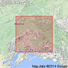
Named for exposures at type section in northeast wall of Dawson Cut placer mine, SW 1/4 sec.6 T1N R1E, on right limit of Engineer Creek near junction with Goldstream Creek, Fairbanks D-2 quad, AK. Previously informally termed "Dawson muck". Composed of peat lenses, logs, and forest beds in a dark gray to black (when frozen) silt, rich in minute carbonized plant fragments. When dry, silt is light gray to tan. Thickness ranges 1 to 3 m. Unconformably overlies Cripple Gravel or Fox Gravel (both new). Unconformably underlies Gold Hill Loess or Goldstream Formation (both new). Carbon 14 determinations on white spruce stump gives ages of >28,000 to 18,300 +/-2000 yr B.P. Is pre-Illinoian interglacial deposit possibly Yarmouthian. Assigned Pleistocene age.
Source: GNU records (USGS DDS-6; Menlo GNULEX).
For more information, please contact Nancy Stamm, Geologic Names Committee Secretary.
Asterisk (*) indicates published by U.S. Geological Survey authors.
"No current usage" (†) implies that a name has been abandoned or has fallen into disuse. Former usage and, if known, replacement name given in parentheses ( ).
Slash (/) indicates name conflicts with nomenclatural guidelines (CSN, 1933; ACSN, 1961, 1970; NACSN, 1983, 2005, 2021). May be explained within brackets ([ ]).

