

- Usage in publication:
-
- Darling Lake Anorthosite Gabbro
- Modifications:
-
- Original reference
- Dominant lithology:
-
- Anorthosite gabbro
- AAPG geologic province:
-
- Northern Cascade Range-Okanagan province
Summary:
Pg. 7205. Darling Lake Anorthosite Gabbro. Most of rocks underlying thesis area were formed under conditions of regional metamorphism and plutonism. After a period of regional metamorphism, magmas ranging from peridotitic to granitic intruded the metamorphic rocks. Resulting igneous bodies have been mapped as Loup Loup Granodiorite, Pogue Mountain Quartz Monzonite, and Darling Lake Anorthosite Gabbro. Age not stated.
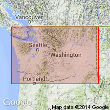
Exposed in Okanogan Range, western part of Cordilleran geosyncline, immediately west of Okanogan, northern WA.
[Name considered informal by the USGS (Menlo GNU index card files, ca. 1983).]
Source: US geologic names lexicon (USGS Bull. 1350, p. 193-194).
- Usage in publication:
-
- Darling Lake Gabbro
- Modifications:
-
- Named
- Dominant lithology:
-
- Gabbro
- AAPG geologic province:
-
- Okanogan province
Summary:
Pg. 479 (fig. 1H), 480, 495. Darling Lake Gabbro. Stock located just north of Darling Lake in north-central Washington. Medium- to coarse-grained hornblende gabbro makes up 95 percent of the stock. Intrudes Salmon Creek Schists and Gneisses (Late Triassic?-Early Cretaceous?). Age is probably Cretaceous.
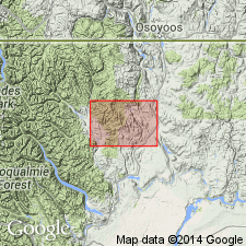
Named from Darling Lake, [Okanogan Co.], north-central WA.
Source: GNC index card files (USGS-Menlo).
For more information, please contact Nancy Stamm, Geologic Names Committee Secretary.
Asterisk (*) indicates published by U.S. Geological Survey authors.
"No current usage" (†) implies that a name has been abandoned or has fallen into disuse. Former usage and, if known, replacement name given in parentheses ( ).
Slash (/) indicates name conflicts with nomenclatural guidelines (CSN, 1933; ACSN, 1961, 1970; NACSN, 1983, 2005, 2021). May be explained within brackets ([ ]).