The National Geologic Map Database is migrating to a new infrastructure. We apologize for any service disruptions during this process.
|
|---|


- Usage in publication:
-
- Beds at Dark Canyon*
- Modifications:
-
- First used
- AAPG geologic province:
-
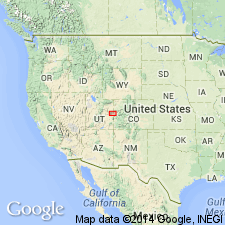
- Paradox basin
Summary:
First published use as separately distinguished informal unit unconformably above the Tuscher and Farrer Formations of Campanian age throughout its extent and unconformably below the Eocene Wasatch Formation in the area from Thompson Canyon northeast to Arroyo Canyon, Grand Co, UT in the Paradox basin. Also called conglomerate beds at Dark Canyon. Palynomorphs identified. Stratigraphic chart. Assigned a late Paleocene age.
Source: GNU records (USGS DDS-6; Denver GNULEX).
- Usage in publication:
-
- Dark Canyon sequence*
- Modifications:
-
- Age modified
- AAPG geologic province:
-
- Paradox basin
- Piceance basin
Summary:
A middle Paleocene [formerly late Paleocene] matrix-supported quartz-pebble conglomerate that grades upward into conglomeratic sandstone, and coarse- to medium-grained sandstone. Newly assigned as basal part of Wasatch Formation. Assigned in earlier papers as separate unit, or to Wasatch, or Tuscher and Farrer Formations. Is first Tertiary depositional event after period of nondeposition and erosion that lasted from Maestrichtian into early to middle? Paleocene time. Unconformably overlies Cretaceous rocks. Difficult to distinguish from overlying Wasatch in subsurface and outcrop. Its exposures parallel Book Cliffs from about 10 mi east of Green River, Grand Co, UT, Paradox basin east to Douglas Pass, Garfield Co, CO, Piceance basin [same area called Uinta basin by authors]. Not present west of Green River. Ranges 60-100 ft thick along west part of outcrop. Thins to 25-38 ft east of Westwater Canyon. Locally eroded in vicinity of CO-UT line. About 95 percent of pebbles are round to subround, black, gray, white chert and quartzite in about equal proportions and up to 6 in long. Some white to gray silicified fossiliferous limestone pebbles. Detrital quartz is dominant constituent of sandstone. Most sand grains angular to subangular. Dominant northwest paleocurrent direction; source from Laramide uplifts to south and southeast. Deposited in rapidly shifting channels in braided rivers that flowed on a medial to distal floodplain.
Source: GNU records (USGS DDS-6; Denver GNULEX).
- Usage in publication:
-
- Dark Canyon sequence*
- Modifications:
-
- Principal reference
- Age modified
- Biostratigraphic dating
- Dominant lithology:
-
- Conglomerate
- Sandstone
- AAPG geologic province:
-
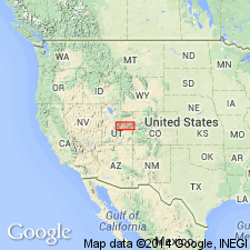
- Paradox basin
Summary:
Considered late early Paleocene rather than upper or middle Paleocene. Species of middle through late Paleocene zones P3 through P6 are absent from all localities sampled. Pollen species MOMIPITES DILATUS, M. LEFFINGWELLI, M. TENUIPOLUS, M. WALTMANENSIS, and M. WYOMINGENSIS present. M. WALTMANENSIS indicates early but not earliest Paleocene age, and is equivalent to zone P2 of Nichols and Ott (1978). As basal part of Wasatch Formation, the Dark Canyon sequence unconformably overlies Tuscher Formation of late Campanian age, and unconformably underlies main body of late Paleocene and Eocene age of Wasatch Formation. Hiatus of perhaps 6 m.y. may separate Dark Canyon sequence at base of Wasatch from main body of Wasatch. Western pinchout is about 10 mi east of Green River. Thickens rapidly eastward to 150 ft in less than 15 mi. East of Westwater Canyon, Grand Co, sequence thins and rarely exceeds 25-35 ft thick. Isolated remnants present near UT-CO state line. Measured sections; correlation chart. Area studied includes Tuscher, Sego and Cottonwood Canyons, and Bitter Creek, Grand Co, UT, Paradox basin. Type section designated in Sego Canyon, secs 3, 15, 28, 33, T20S, R20E where sequence is 130+ ft thick massive to crudely horizontally stratified conglomerate and sandstone. Pebble size decreases upward. Has abundant rip-up clasts of gray to orange pedogenic carbonate nodules, chert, quartzite, and limestone pebbles.
Source: GNU records (USGS DDS-6; Denver GNULEX).
For more information, please contact Nancy Stamm, Geologic Names Committee Secretary.
Asterisk (*) indicates published by U.S. Geological Survey authors.
"No current usage" (†) implies that a name has been abandoned or has fallen into disuse. Former usage and, if known, replacement name given in parentheses ( ).
Slash (/) indicates name conflicts with nomenclatural guidelines (CSN, 1933; ACSN, 1961, 1970; NACSN, 1983, 2005, 2021). May be explained within brackets ([ ]).