The National Geologic Map Database is migrating to a new infrastructure. We apologize for any service disruptions during this process.
|
|---|


- Usage in publication:
-
- Danby formation*
- Modifications:
-
- Original reference
- Dominant lithology:
-
- Quartzite
- Dolomite
- Slate
- AAPG geologic province:
-
- New England province
Summary:
Pg. 360, 396. Danby formation. Is a departure from the usual carbonate deposits of the Valley. Great variety of beds in the formation, but they are separated from the other formations chiefly by amount of sandstone and quartzite and by their varicolored dolomites. The quartzite beds are composed of clean white sand, in layers 1 or 2 feet thick, interbedded with massive dolomites like those of underlying Rutland dolomite, and with transitional strata, like sandy dolomites and sandstone. The quartzite beds usually stand out like white reefs above the other layers. Some peculiar dolomites, of pink, buff, and green colors, also occur. These are very fine-grained and tough and form ridges. Associated are thin seams and layers of greenish slate. Beds considerably folded. Thickness 300+/- feet. Grades into overlying Wallingford dolomite. Is = Hubbardton slate, Stiles phyllite, and Brezee phyllite. Age is Early Cambrian.
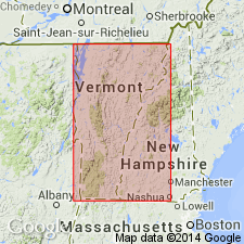
[Named for fact it surrounds town of Danby, in Wallingford quadrangle, Rutland Co., southwestern VT.]
Source: US geologic names lexicon (USGS Bull. 896, p. 570).
- Usage in publication:
-
- Danby formation
- Modifications:
-
- Revised
- Age modified
- AAPG geologic province:
-
- New England province
Summary:
Pg. 522-523 (fig. 3), 525, 535-536. Danby formation. Stratigraphically extended to include overlying beds, formerly the Wallingford formation, as Wallingford member (Franconian). Thickness 400 to 800 feet. Underlies Clarendon Springs dolomite. Age is considered Late Cambrian and possibly Middle Cambrian(?).
Source: Publication; US geologic names lexicon (USGS Bull. 1200, p. 1040).
- Usage in publication:
-
- Danby formation
- Modifications:
-
- Areal extent
- AAPG geologic province:
-
- New England province
Summary:
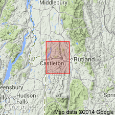
Pg. 22-23. Danby formation. Described in Castleton area. Crops out in narrow belt extending from boundary of Castleton and Brandon quadrangles through Florence and Procter to western slopes of Pine Hill. Southern exposures cover area extending from boundary of quadrangle southwest of Chippenhook northward to western slope of Boardman Hill. Includes Wallingford member in upper part. Overlies Winooski dolomite; underlies Clarendon Springs dolomite. Thickness about 700 feet. Age is considered Late Cambrian.
Source: US geologic names lexicon (USGS Bull. 1200, p. 1040).
- Usage in publication:
-
- Danby Formation
- Modifications:
-
- Revised
- Mapped
- Dominant lithology:
-
- Dolomite
- Sandstone
- AAPG geologic province:
-
- New England province
Summary:
Pg. 43-45, geol. map. Danby Formation of Woods Corner Group. Grades laterally into geologic units of Woods Corner Group (Mill River Conglomerate, Skeels Corner Formation, Rockledge Conglomerate, Saxe Brook Formation, and Hungerford shales of St. Albans area) and is assigned to group. Consists of gray dolomitic sandstone beds, up to a foot thick, separated by thicker beds of arenaceous dolomite, and minor shale and limestone, notably at the base and top. Thickness up to 550 feet. Fossils (possible worm borings). Age is considered Middle Cambrian (Dresbachian), based on stratigraphic relations.
Source: Publication.
- Usage in publication:
-
- Danby Formation*
- Modifications:
-
- Revised
- AAPG geologic province:
-
- New England province
Summary:
Shown as part of the Stockbridge Group in illustrations. Age changed to Late Cambrian. [No explanation given to explain changes.]
Source: GNU records (USGS DDS-6; Reston GNULEX).

- Usage in publication:
-
- Danby Formation
- Modifications:
-
- Age modified
- AAPG geologic province:
-
- New England province
Summary:
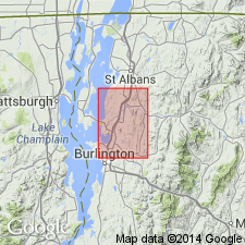
Figure 3 shows Danby as Middle Ordovician. [No explanation given for age variation. Late Cambrian age remains good usage elsewhere.] Map area is northwestern VT.
Source: GNU records (USGS DDS-6; Reston GNULEX).

- Usage in publication:
-
- Danby Formation*
- Modifications:
-
- Areal extent
- AAPG geologic province:
-
- New England province
Summary:
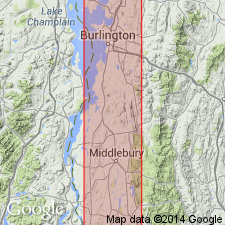
Stratigraphic succession in Middlebury synclinorium in north-central part of Glens Falls quad consists of (ascending) Late Proterozoic Dalton Formation and Pinnacle Formation, Lower Cambrian Cheshire Quartzite, Lower and Middle Cambrian dolomites (Rutland Dolomite, Dunham Dolomite as used by Cady (1945), Winooski Dolomite) with minor quartzite (Monkton Formation), and Upper Cambrian Danby Formation. Danby is in part correlative with Potsdam Sandstone and Ticonderoga Formation to the south. Above Danby is series of limestones and dolomites directly correlative with Beekmantown Group and partly correlative with Chazy Group to the south. Middlebury synclinorium is considered a parautochthonous shelf sequence.
Source: GNU records (USGS DDS-6; Reston GNULEX).
For more information, please contact Nancy Stamm, Geologic Names Committee Secretary.
Asterisk (*) indicates published by U.S. Geological Survey authors.
"No current usage" (†) implies that a name has been abandoned or has fallen into disuse. Former usage and, if known, replacement name given in parentheses ( ).
Slash (/) indicates name conflicts with nomenclatural guidelines (CSN, 1933; ACSN, 1961, 1970; NACSN, 1983, 2005, 2021). May be explained within brackets ([ ]).