The National Geologic Map Database is migrating to a new infrastructure. We apologize for any service disruptions during this process.
|
|---|


- Usage in publication:
-
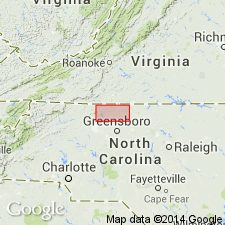
- Dan River Group
- Modifications:
-
- Named
- Dominant lithology:
-
- Conglomerate
- Sandstone
- Mudstone
- AAPG geologic province:
-
- Piedmont-Blue Ridge province
Summary:
The Dan River Group is here named for up to 15,000 ft of red, tan, and gray nonmarine conglomerate, sandstone, and mudrock in the Dan River basin, NC. It is divided into the Pine Hall, Cow Branch, and Stoneville Formations, which unconformably overlie and are locally in fault contact with older metamorphic rocks on the southeast side of the basin, and are truncated by the Dan River fault zone on the northwest side. Age is Late Triassic.
Source: GNU records (USGS DDS-6; Reston GNULEX).
- Usage in publication:
-
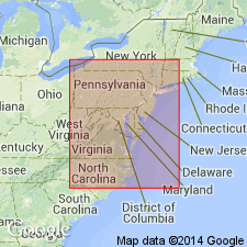
- Dan River Group
- Modifications:
-
- Revised
- AAPG geologic province:
-
- Dan River-Danville basin
- Piedmont-Blue Ridge province
Summary:
The Dan River Group and its Pine Hall, Cow Branch, and Stoneville Formations in the Dan River basin are here assigned to the Newark Supergroup.
Source: GNU records (USGS DDS-6; Reston GNULEX).
- Usage in publication:
-
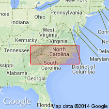
- Dan River Group*
- Modifications:
-
- Revised
- Areal extent
- AAPG geologic province:
-
- Davie County basin
- Piedmont-Blue Ridge province
Summary:
The Dan River Group, undivided, of the Newark Supergroup is used in the Davie County basin.
Source: GNU records (USGS DDS-6; Reston GNULEX).
For more information, please contact Nancy Stamm, Geologic Names Committee Secretary.
Asterisk (*) indicates published by U.S. Geological Survey authors.
"No current usage" (†) implies that a name has been abandoned or has fallen into disuse. Former usage and, if known, replacement name given in parentheses ( ).
Slash (/) indicates name conflicts with nomenclatural guidelines (CSN, 1933; ACSN, 1961, 1970; NACSN, 1983, 2005, 2021). May be explained within brackets ([ ]).