The National Geologic Map Database is migrating to a new infrastructure. We apologize for any service disruptions during this process.
|
|---|


- Usage in publication:
-
- Dalton phyllite*
- Modifications:
-
- [First used]
- Dominant lithology:
-
- Phyllite
- AAPG geologic province:
-
- New England province
Summary:
[Dalton phyllite is shown as underlying Hoosac schist and as overlying [underlying] Cheshire quartzite which rests on Becket gneiss.]
Source: US geologic names lexicon (USGS Bull. 896, p. 978-568).
- Usage in publication:
-
- Dalton phyllite*
- Modifications:
-
- Overview
- AAPG geologic province:
-
- New England province
Summary:
Included the Dalton in Cheshire quartzite as defined and mapped. His map included Dalton type locality.
Source: US geologic names lexicon (USGS Bull. 896, p. 978-568).

- Usage in publication:
-
- Dalton formation*
- Modifications:
-
- Revised
- AAPG geologic province:
-
- New England province
Summary:
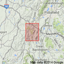
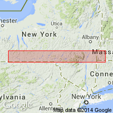
Pg. 32-34 and map. Dalton formation. At some places in western Massachusetts the lowermost Cambrian strata consist of gneissoid conglomerate having maximum thickness of 600 or 700 feet. The pebbles are chiefly quartz (black, blue, and commonly white) but a few are feldspar or gneiss [between 5 and 100 mm long]. This conglomerate can be traced for miles across Hinsdale and into Washington [western Massachusetts]. Is best exposed at site of former Dalton clubhouse, on high hill south of Dalton Station, in open pasture farther south and on southeast to new lookout tower. The conglomerate was originally feldspathic and has generally changed to a thin fissile light-colored gneiss or schist in which the muscovite is generally a greasy hydrated sericite. Grades into overlying Cheshire quartzite. Rests unconformably on Becket gneiss. Age is Early Cambrian. [According to personal communication of B.K. Emerson, the Dalton formation of 1917 publication is same as Dalton phyllite of 1892 Hawley sheet.]
Source: US geologic names lexicon (USGS Bull. 896, p. 568); supplemental information from GNU records (USGS DDS-6; Reston GNULEX).
- Usage in publication:
-
- Dalton formation
- Modifications:
-
- Areal extent
- AAPG geologic province:
-
- New England province
Summary:
Correlation chart for Vermont shows Dalton formation in southwestern part of the State below Cheshire quartzite. Age is Early Cambrian.
Source: GNU records (USGS DDS-6; Reston GNULEX).
- Usage in publication:
-
- Dalton Formation*
- Modifications:
-
- Age modified
- AAPG geologic province:
-
- New England province
Summary:
Age of Dalton Formation changed from Early Cambrian to Cambrian(?).
Source: GNU records (USGS DDS-6; Reston GNULEX).
- Usage in publication:
-
- Dalton Formation*
- Modifications:
-
- Age modified
- AAPG geologic province:
-
- New England province
Summary:
Age of Dalton Formation changed to Early Cambrian and late Precambrian(?).
Source: GNU records (USGS DDS-6; Reston GNULEX).
- Usage in publication:
-
- Dalton Formation*
- Modifications:
-
- Areal extent
- AAPG geologic province:
-
- New England province
Summary:
Geographically extended into northernmost Connecticut on map (fig. 1 of report). Mapped undivided with Cheshire Quartzite. Age is Early Cambrian and late Precambrian(?).
[GNU staff remark (1990): Harwood's 1979 map of the South Sandisfield quadrangle (USGS GQ-1519) confirms presence only of Dalton in Connecticut; no Cheshire mapped in Connecticut in that quadrangle which covers same area as this paper.]
Source: GNU records (USGS DDS-6; Reston GNULEX).
- Usage in publication:
-
- Dalton Formation*
- Modifications:
-
- Age modified
- AAPG geologic province:
-
- New England province
Summary:
Age changed to Proterozoic Z(?) and Early Cambrian.
Source: GNU records (USGS DDS-6; Reston GNULEX).
- Usage in publication:
-
- Dalton Formation*
- Modifications:
-
- Age modified
- AAPG geologic province:
-
- New England province
Summary:
Age changed to Proterozoic Z and Early Cambrian as shown on figure 1 of report.
Source: GNU records (USGS DDS-6; Reston GNULEX).

- Usage in publication:
-
- Dalton Formation*
- Modifications:
-
- Overview
- AAPG geologic province:
-
- New England province
Summary:
Used as Dalton Formation of Proterozoic Z and Early Cambrian age. Consists of one undivided formation and five informal members distinguished lithologically.
Source: GNU records (USGS DDS-6; Reston GNULEX).

- Usage in publication:
-
- Dalton Formation*
- Modifications:
-
- Areal extent
- AAPG geologic province:
-
- New England province
Summary:
Stratigraphic succession in Middlebury synclinorium in north-central part of Glens Falls quadrangle consists of (ascending) Late Proterozoic Dalton Formation and Pinnacle Formation, Lower Cambrian Cheshire Quartzite, Lower and Middle Cambrian dolomites (Rutland Dolomite, Dunham Dolomite as used by Cady (1945), Winooski Dolomite) with minor quartzite (Monkton Formation), and Upper Cambrian Danby Formation. Middlebury synclinorium is considered a parautochthonous shelf sequence.
Source: GNU records (USGS DDS-6; Reston GNULEX).
- Usage in publication:
-
- Dalton Formation*
- Modifications:
-
- Revised
- AAPG geologic province:
-
- New England province
Summary:
Rocks previously mapped as Mendon Formation in this area are here called Dalton Formation following the usage on the Vermont State geologic map by Doll and others (1961).
Source: GNU records (USGS DDS-6; Reston GNULEX).
For more information, please contact Nancy Stamm, Geologic Names Committee Secretary.
Asterisk (*) indicates published by U.S. Geological Survey authors.
"No current usage" (†) implies that a name has been abandoned or has fallen into disuse. Former usage and, if known, replacement name given in parentheses ( ).
Slash (/) indicates name conflicts with nomenclatural guidelines (CSN, 1933; ACSN, 1961, 1970; NACSN, 1983, 2005, 2021). May be explained within brackets ([ ]).