- Usage in publication:
-
- Daggett Ridge Formation*
- Modifications:
-
- Named
- Dominant lithology:
-
- Conglomerate
- Slate
- Siltstone
- AAPG geologic province:
-
- New England province
Summary:
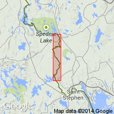
Chloritic argillaceous quartzite, quartzite metaconglomerate with fractured pebbles and cobbles as large as 8 by 12 in., gray and gray-green slate and metasiltstone, thin magnetite-bearing interbedded black slate and metasiltstone lenses that crop out in Wytopitlock quad. here named Daggett Ridge Formation. Unit also includes thin green cherty lenses of rhyolitic metatuff along Baskahegan Stream near South Bancroft, Danforth quad. Exposed over width of 8,000 ft in Danforth quad where quartzite and metaconglomerate form most of thickness estimated to exceed 1,000 ft. Older than Chiputneticook Quartz Monzonite (new). Silurian age based on presence of single dorsal valve of orthoid brachiopod.
Source: GNU records (USGS DDS-6; Reston GNULEX).

- Usage in publication:
-
- Daggett Ridge Formation
- Modifications:
-
- Revised
- AAPG geologic province:
-
- New England province
Summary:
Daggett Ridge Formation is redefined and assigned to the Prentiss Group (new). Original description included rocks assigned in this report to several other units. Larrabee (1963) mapped the Daggett Ridge across the North Bancroft fault and included in his unit, rocks now assigned to Baskahegan Lake Formation, Carys Mills Formation, Smyrna Mills Formation, and other Prentiss Group units. Author favors the view that the Daggett Ridge interfingers westward with the Mill Priviledge Brook, Sam Rowe Ridge, and Ellen Wood Ridge Formations (all new), also of the Prentiss Group. Daggett Ridge is restricted to pebble, cobble, and boulder conglomerates interbedded with subordinate amounts of slate, siltstone, and sandstone exposed along Daggett Ridge, on Jimmy Mountain, in Baskahegan Stream, and along the Canadian Pacific RR tracks in the Danforth quad., and across the Mattawamkeag River from Bancroft in the Wytopitlock quad. A Silurian through Early Devonian age is possible based on brachiopods and rugose corals. Author favors a Late Silurian age. [Formation names introduced in this paper are considered informal by the GNU until publication of a formal naming paper.]
Source: GNU records (USGS DDS-6; Reston GNULEX).

- Usage in publication:
-
- Daggett Ridge Formation
- Modifications:
-
- Age modified
- Overview
- AAPG geologic province:
-
- New England province
Summary:
Post-Caradocian Miramichi rocks may be divided into four formations. The generally conglomeratic rocks are grouped as the Daggett Ridge Formation, which is considered to be approximately time-equivalent to the other three and therefore is probably a more proximal facies. All four (Daggett Ridge, Mill Priveledge Brook, Sam Rowe Ridge, and Ellen Wood Ridge Formations) appear to interfinger. The Daggett Ridge consists almost entirely of massive clast-supported conglomerates. It is exposed in the northwest corner of the Wytopitlock quad and the northeast corner of the Danforth quad. Clast sizes range from pebble-to-cobble size over most of the unit but in some areas of the Danforth quad, reach boulder-size (10 to 12 ft across). Clast lithology is dominated by quartzofeldspathic wackes similar to those of the Baskahegan Lake Formation. Though originally thought to be as young as Early Devonian, age is now interpreted to range from Late Ordovician to Middle(?) Silurian as a result of recent detailed mapping.
Source: GNU records (USGS DDS-6; Reston GNULEX).
For more information, please contact Nancy Stamm, Geologic Names Committee Secretary.
Asterisk (*) indicates published by U.S. Geological Survey authors.
"No current usage" (†) implies that a name has been abandoned or has fallen into disuse. Former usage and, if known, replacement name given in parentheses ( ).
Slash (/) indicates name conflicts with nomenclatural guidelines (CSN, 1933; ACSN, 1961, 1970; NACSN, 1983, 2005, 2021). May be explained within brackets ([ ]).

