

- Usage in publication:
-
- D-Cross tongue*
- Modifications:
-
- Named
- Dominant lithology:
-
- Shale
- Sandstone
- AAPG geologic province:
-
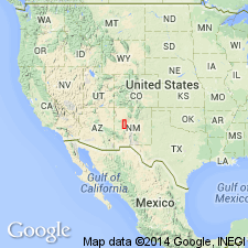
- Orogrande basin
Summary:
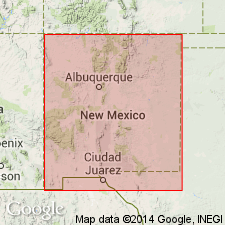
Named as a member of Mancos shale for rocks at D-Cross Mountain, Socorro Co, NM in the Orogrande basin. Type locality is in secs 17 and 18, T3N, R8W. Composed of drab fossiliferous shale with interbedded sandstone. Three sandstones recognized at Puertocito. Is 170 ft thick at D-Cross Mountain where it overlies lower part of Gallup sandstone and underlies Gallego sandstone member of Gallup sandstone (formerly of Miguel formation). Considered to be a distinct and higher marine shale than the Pescado tongue of Mancos. Contains a Carlile fauna (ammonites). Of Late Cretaceous age. Measured sections. Geologic map.
Source: GNU records (USGS DDS-6; Denver GNULEX).
- Usage in publication:
-
- D-Cross Tongue*
- Modifications:
-
- Revised
- Areal extent
- Overview
- AAPG geologic province:
-
- Orogrande basin
Summary:
Disconformably overlies the Fite Ranch Sandstone Member (new) of Tres Hermanos Formation (raised in stratigraphic rank) from D-Cross Mountain, Socorro Co. to Carthage, Socorro Co., NM. Assigned to the Upper Cretaceous Mancos Shale. From Cebollita Mesa northwest where the F sandstone of the Gallup can be recognized, equivalent rocks are assigned to the Pescado Tongue of the Mancos.
Source: GNU records (USGS DDS-6; Denver GNULEX).

- Usage in publication:
-
- D-Cross Tongue*
- Modifications:
-
- Biostratigraphic dating
- AAPG geologic province:
-
- Orogrande basin
Summary:
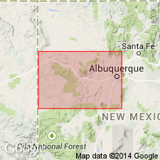
Is member of Mancos Shale. Biostratigraphic dating on basis of ammonites from limestone concretion from USGS Mesozoic locality D10127 in N1/2, sec 7, T2N, R5W, Socorro Co, NM in Orogrande basin. REESIDITES MINIMUS associated with PRIONOCYCLUS NOVIMEXICANUS indicating the upper Turonian SCAPHITES WHITFIELD Zone (Cobban and Hook, 1984, p. 269). Age is late Turonian (Late Cretaceous).
Source: GNU records (USGS DDS-6; Denver GNULEX).
- Usage in publication:
-
- D-Cross Tongue*
- Modifications:
-
- Biostratigraphic dating
- Areal extent
- Overview
- AAPG geologic province:
-
- San Juan basin
Summary:
Is tongue of the Mancos Shale that separates Tres Hermanos Formation (below) from Gallup Sandstone (above) in the Acoma Pueblo area, Cibola Co in San Juan basin in west-central NM. Unit is best developed to the south in D Cross Mountain-Puertecito area of northwestern Socorro Co, NM. Fossils are fairly abundant in limestone concretions. Unit is late Turonian age, spanning the ammonite zones of PRIONOCYCLUS WYOMINGENSIS, SCAPHITES WHITFIELDI, and PRIONOCYCLUS QUADRATUS. Figure 2 is stratigraphic nomenclature and correlation chart of middle Cenomanian to lower Coniacian rocks in west-central NM, spanning 20 ammonite zones.
Source: GNU records (USGS DDS-6; Denver GNULEX).
For more information, please contact Nancy Stamm, Geologic Names Committee Secretary.
Asterisk (*) indicates published by U.S. Geological Survey authors.
"No current usage" (†) implies that a name has been abandoned or has fallen into disuse. Former usage and, if known, replacement name given in parentheses ( ).
Slash (/) indicates name conflicts with nomenclatural guidelines (CSN, 1933; ACSN, 1961, 1970; NACSN, 1983, 2005, 2021). May be explained within brackets ([ ]).