The National Geologic Map Database is migrating to a new infrastructure. We apologize for any service disruptions during this process.
|
|---|


- Usage in publication:
-
- Cuyamaca basic intrusive
- Modifications:
-
- Original reference
- Dominant lithology:
-
- Gabbro
- Norite
- Diorite
- AAPG geologic province:
-
- Peninsular Ranges province
Summary:
Pg. 181, 192-207, map. Cuyamaca basic intrusive. Chiefly gabbros, norites, and basic diorites. Three units mapped (1) hypersthene diorite, (2) augite diorite, and (3) norite, gabbro, etc. Cuts Julian schist and Stonewall quartz diorite. Age is probably pre-Cretaceous.
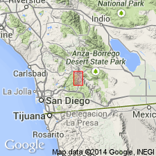
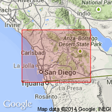
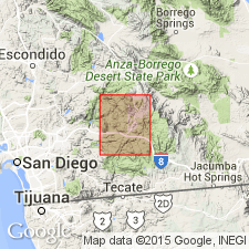
[Type locality not designated.] Named from the three peaks of Cuyamaca Mountains [in T. 13 and 14 S., R. 3 and 4 E., Julian-Cuyamaca area, southeastern part of Ramona quadrangle and northeastern part of Cuyamaca quadrangle], San Diego Co., southern CA.
Source: US geologic names lexicon (USGS Bull. 896, p. 562); supplemental information from GNU records (USGS DDS-6; Menlo GNULEX).
- Usage in publication:
-
- Cuyamaca gabbro*
- Modifications:
-
- Redescribed
- Mapped
- Dominant lithology:
-
- Gabbro
- AAPG geologic province:
-
- Peninsular Ranges province
Summary:
Pg. 18, 19-21, pl. 3. Cuyamaca gabbro. Described in Julian-Cuyamaca area as Cuyamaca gabbro. Youngest rock in area; intrusive into Julian schist and Stonewall quartz diorite. Adopted on recommendation of S.C. Creasey and Wilbur Burbank. Subdivided in field on estimated content of feldspar. Age is considered Mesozoic.
Mapped in Friday Mine-Inspiration Point area.
Source: US geologic names lexicon (USGS Bull. 1200, p. 1023); GNU records (USGS DDS-6; Menlo GNULEX).
- Usage in publication:
-
- Cuyamaca basic intrusive
- Modifications:
-
- Not used
- AAPG geologic province:
-
- Peninsular Ranges province
Summary:
Pg. 234. Mapping in Ramona area has shown that Cuyamaca basic intrusive (Hudson, 1922) and San Marcos gabbro (Miller, 1937) are probably the same. In this area, name San Marcos is applied.
Source: US geologic names lexicon (USGS Bull. 1200, p. 1023).
- Usage in publication:
-
- Cuyamaca gabbro*
- Modifications:
-
- Mapped
- Age modified
- Dominant lithology:
-
- Gabbro
- AAPG geologic province:
-
- Peninsular Ranges province
Summary:
Pg. 66-74, pls. 3, 4, 5. Cuyamaca gabbro. Described in Cuyamaca Peak 15-min quadrangle, San Diego County, California. Writer followed Creasey (1946) in referring to rocks as Cuyamaca gabbro, thereby retaining original locality name given by Hudson, but substituting more appropriate gabbro for term basic intrusive. Considered older than Green Valley tonalite. Age is considered Late Cretaceous (= age of main sequence of batholithic rocks of southern part of California).
Source: Publication; US geologic names lexicon (USGS Bull. 1200, p. 1023).
- Usage in publication:
-
- Cuyamaca Gabbro*
- Modifications:
-
- Areal extent
- AAPG geologic province:
-
- Peninsular Ranges province
Summary:
Sketch mapped in Cuyamaca 7.5' quad, San Diego Co., CA with vertical sections. Associated with granodiorite-tonalite of Cuyamaca Reservoir, quartz monzonite of Chiquito Park and Pine Valley, and diorite-gabbro of East Mesa (all of Cretaceous age).
Source: GNU records (USGS DDS-6; Menlo GNULEX).
- Usage in publication:
-
- Cuyamaca Gabbro*
- Modifications:
-
- Age modified
- Areal extent
- AAPG geologic province:
-
- Peninsular Ranges province
Summary:
Sketch mapped in the Sill Hill and Hauser roadless areas. Assigned Early Cretaceous age [based on intrusive relationships with granitic rocks of Lower Cretaceous age.]
Source: GNU records (USGS DDS-6; Menlo GNULEX).
- Usage in publication:
-
- Cuyamaca Gabbro*
- Modifications:
-
- Areal extent
- AAPG geologic province:
-
- Peninsular Ranges province
Summary:
Extended into and sketch mapped in El Cajon Mountain 7.5' quad and Cuyamaca Mtns. gabbro-granitoid complex area, San Diego Co., CA.
Source: GNU records (USGS DDS-6; Menlo GNULEX).
- Usage in publication:
-
- Cuyamaca Gabbro*
- Modifications:
-
- Areal extent
- AAPG geologic province:
-
- Peninsular Ranges province
Summary:
Geographically extended on map figure to Southern Otay Mountain wilderness area. Assigned Cretaceous age.
Source: GNU records (USGS DDS-6; Menlo GNULEX).
For more information, please contact Nancy Stamm, Geologic Names Committee Secretary.
Asterisk (*) indicates published by U.S. Geological Survey authors.
"No current usage" (†) implies that a name has been abandoned or has fallen into disuse. Former usage and, if known, replacement name given in parentheses ( ).
Slash (/) indicates name conflicts with nomenclatural guidelines (CSN, 1933; ACSN, 1961, 1970; NACSN, 1983, 2005, 2021). May be explained within brackets ([ ]).