The National Geologic Map Database is migrating to a new infrastructure. We apologize for any service disruptions during this process.
|
|---|


- Usage in publication:
-
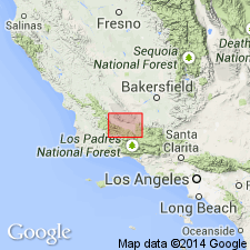
- Cuyama formation*
- Modifications:
-
- Named
- Dominant lithology:
-
- Sand
- Clay
- Gravel
- AAPG geologic province:
-
- Transverse Ranges province
Summary:
Named for outcrops that occur only in Cuyama Valley, Santa Barbara and Ventura Cos, CA. Consists of nonmarine yellow and pink sands, clays, and gravel. In eastern part of Santa Ynez quad, unit is probably not over 250 or 300 ft thick. Unconformably overlies Santa Margarita formation. Underlies Quaternary terrace gravels. No fossils were found. Map legend shows Pliocene(?) age [based on regional correlation].
Source: GNU records (USGS DDS-6; Menlo GNULEX).
For more information, please contact Nancy Stamm, Geologic Names Committee Secretary.
Asterisk (*) indicates published by U.S. Geological Survey authors.
"No current usage" (†) implies that a name has been abandoned or has fallen into disuse. Former usage and, if known, replacement name given in parentheses ( ).
Slash (/) indicates name conflicts with nomenclatural guidelines (CSN, 1933; ACSN, 1961, 1970; NACSN, 1983, 2005, 2021). May be explained within brackets ([ ]).