

- Usage in publication:
-
- Cutler Dam Alloformation
- Modifications:
-
- Named
- Dominant lithology:
-
- Mud
- Sand
- AAPG geologic province:
-
- Great Basin province
Summary:
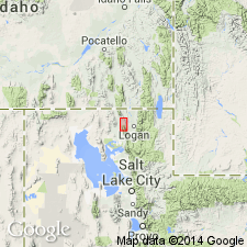
Named from Cutler Dam on the Bear River in Box Elder Co, UT, Great Basin province. Holostratotype locality includes five measured and numbered stratigraphic sections: sec 1--lat 41 deg 42' 55" N, long 112 deg 6' 28" W, Honeyville; sec 2--lat 41 deg 46' 54" N, long 112 deg 6' 18" W, Cutler Dam; sec 5--lat 41 deg 48' 36" N, long 112 deg 4' 54" W, Cutler Dam; sec 6--lat 41 deg 48' 57" N, long 112 deg 4' 21" W, Cutler Dam; and sec 7--lat 41 deg 49' 30" N, long 112 deg 4' 36" W, Cutler Dam. Consists of lacustrine and marginal-lacustrine mud and fine to medium sand; unoxidized sediment is light to dark gray; oxidized sediment is yellowish brown. Thickness varies from several meters to over 25 m. Ripple laminations in sand suggest shallow-water environment. Deposited during a newly recognized late Pleistocene lake cycle called the Cutler Dam cycle. Disconformably underlies Bonneville Alloformation; distinguished from Bonneville by presence of Fielding Geosol (new). At few localities, unconformably overlies structurally deformed upper Tertiary basin-fill rocks. Schematic diagram; measured stratigraphic sections; fossil list (mollusks, ostracods, vertebrates, plants). Age given as early or middle Wisconsin, late Pleistocene. Age bracketed by radiocarbon dates (greater than 36,000 yr B.P. from wood from coarse sand near base of section 6), amino acid analyses show it is younger than Little Valley Alloformation, and soil development.
Source: GNU records (USGS DDS-6; Denver GNULEX).
For more information, please contact Nancy Stamm, Geologic Names Committee Secretary.
Asterisk (*) indicates published by U.S. Geological Survey authors.
"No current usage" (†) implies that a name has been abandoned or has fallen into disuse. Former usage and, if known, replacement name given in parentheses ( ).
Slash (/) indicates name conflicts with nomenclatural guidelines (CSN, 1933; ACSN, 1961, 1970; NACSN, 1983, 2005, 2021). May be explained within brackets ([ ]).