

- Usage in publication:
-
- Cusseta sand member*
- Modifications:
-
- Original reference
- Dominant lithology:
-
- Sand
- Clay
- AAPG geologic province:
-
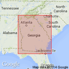
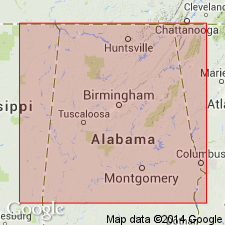
- South Georgia sedimentary province
Summary:
Pg. 86-89. Cusseta sand member of Ripley formation. Noncalcareous sands and clays. The sands, which predominate, are made up of quartz and mica, are unconsolidated, varicolored, cross-bedded, and generally fine-grained. They are unfossiliferous except for lignitized and silicified wood, and are often very ferruginous, containing thin crusts and layers of siliceous limonite, and limonitic nodules. In the sand are pockets of white, drab, and black, massive-bedded clays, and also thin lenticular layers of laminated clays. The clay is both light and dark colored and massive bedded, and contains well-preserved fossil leaves and minute cubes of pyrite. Underlies Renfroes marl and overlies Blufftown marl, the basal member of Ripley. Thickness 250 to 800 feet. [Age is Late Cretaceous.]
[Named from exposures in vicinity of Cusseta, Chattahoochee Co., western GA.]
Source: US geologic names lexicon (USGS Bull. 896, p. 558-559).
- Usage in publication:
-
- Cusseta sand member*
- Modifications:
-
- Areal extent
- AAPG geologic province:
-
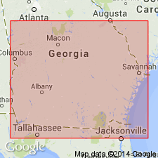
- South Georgia sedimentary province
Summary:
Pg. 135, 151-153, 155. Northeastward from Chattahoochee River, the basal 200 or 300 feet of the marine beds composing Ripley formation merge along the strike into shallow-water equivalents (Cusseta sand member), which differ in their essential lithologic characters from typical Ripley beds. The Cusseta member consists of irregularly bedded unconsolidated sands, with subordinate clay lenses, probably of sound or estuarine origin, but perhaps in part of shallow marine origin. Typical marine beds ("Renfroes marl" of Veatch) separate Cusseta sand member from overlying Providence sand member in narrow belt from Chattahoochee region through Stewart, Chattahoochee, Marion, and Schley Counties, to Macon County, where they appear to pinch out, so far as surface outcrops are concerned, but there is evidence that buried representatives of these typical marine beds extend east at least as far as Marshallville. The similarity of the materials of Cusseta sand member to the shallow-water phase of the underlying Eutaw formation in its eastern extension renders the two formations separable only with difficulty, and the same is true of this member with respect to the overlying Providence sand member, where the intervening marine beds pinch out. The Cusseta member outcrops in parts of Stewart, Chattahoochee, Marion, Schley, Taylor, Macon, Crawford, Houston, Bibb, and Twiggs Counties. [p. 151-153.]
[On p. 135 of above report is a section at Blufftown, which gives thickness of Cusseta member as 100 feet, and shows it underlain by 50 feet of "typical marine beds" of Ripley, consisting of gray calcareous sand with some fossils, which forms top bed of Veatch's "Blufftown marl," the rest of the †Blufftown being the gray, calcareous, glauconitic sand and gray calcareous arenaceous clay that form upper 45 feet of Eutaw formation.]
Source: US geologic names lexicon (USGS Bull. 896, p. 558-559).
- Usage in publication:
-
- Cusseta sand member*
- Modifications:
-
- Areal extent
- AAPG geologic province:
-
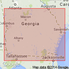
- South Georgia sedimentary province
Summary:
Pg. 65. Repeated foregoing description [Veatch and Stephenson, 1911] of Cusseta sand member but did not repeat the Blufftown section and did not describe any typical Ripley beds as underlying Cusseta member, but described the Cusseta as basal member of Ripley formation and Tombigbee sand as upper member of Eutaw formation. All subsequent reports (Georgia Geol. Survey Bulls., no. 21, 1916; no. 31, 1917; and no. 44, 1929; and Jour Geol., v. 27, p. 177-179, 1919) treat Cusseta sand as basal member of Ripley and Tombigbee sand as upper member of Eutaw formation. Whether the 50 feet of Ripley marine beds said to underlie the Cusseta in the several counties mentioned above are now included in Cusseta sand member or in underlying Eutaw formation is not apparent, but, being marine, they are probably included in Tombigbee sand member. [Age is Late Cretaceous.]
Source: US geologic names lexicon (USGS Bull. 896, p. 558-559).
- Usage in publication:
-
- Cusseta sand*
- Modifications:
-
- Revised
- AAPG geologic province:
-
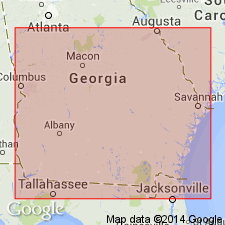
- South Georgia sedimentary province
Summary:
Pg. 790-791. Cusseta sand. Rank raised to formation. In western Georgia, overlaps Blufftown and Eutaw formations in Marion County and extends eastward on the Tuscaloosa as far as Peach County, where it is overlain by basal Eocene Clayton formation. Above the Cusseta is more than 100 feet of dark-gray micaceous sand representing the Ripley formation. [Age is Late Cretaceous.]
Source: US geologic names lexicon (USGS Bull. 1200, p. 1014-1015).
- Usage in publication:
-
- Cusseta sand*
- Modifications:
-
- Areal extent
- AAPG geologic province:
-
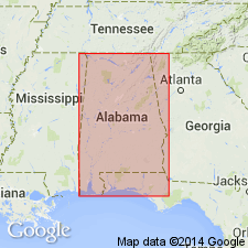
- Mid-Gulf Coast basin
Summary:
Pg. 1643 (fig. 2), 1649-1650. Cusseta sand. Geographically extended into eastern Alabama where it merges into Selma chalk; merging takes place in an east-west stretch of 15 or 20 miles in region south of Montgomery; intertonguing consists of two main westward extending tongues of sand, one below and one above an eastward extending tongue of chalk. In its westward continuation through Alabama, the updip near-shore facies of Cusseta becomes a coarse sand with fine-gravel lenses in basal part. North-facing escarpment known as Chunnenuggee Ridge, which extends from Union Springs eastward toward Chattahoochee River, is physiographic expression of the Cusseta. Underlies Ripley formation; presence of unconformity separating the two not established. [Age is Late Cretaceous.]
Source: US geologic names lexicon (USGS Bull. 1200, p. 1014-1015).
- Usage in publication:
-
- Cusseta sand member*
- Modifications:
-
- Revised
- AAPG geologic province:
-
- Mid-Gulf Coast basin
Summary:
Pg. 44, 45. Cusseta sand member of Ripley formation. In this report [Cretaceous of east-central Alabama], the Cusseta is considered a member of Ripley formation. [Age is Late Cretaceous.]
Source: US geologic names lexicon (USGS Bull. 1200, p. 1014-1015).

- Usage in publication:
-
- Cusseta Sand
- Modifications:
-
- Revised
- AAPG geologic province:
-
- Mid-Gulf Coast basin
Summary:
Cusseta Sand Member of Ripley Formation here raised in rank to Cusseta Sand in Alabama. Unit also is formational rank in Georgia (citing Pickering and others, 1976). Cusseta is lateral equivalent of the Demopolis Chalk and is separated from the Ripley by a sharp lithic boundary. Consists of five general sedimentary facies: (1) OPHIOMORPHA-bearing, medium- to coarse-grained, trough and planar cross-bedded sand (barrier island); (2) interlaminated fine sand and silty clay (back barrier); (3) bioturbated clayey fine sand, (4) glauconitic siltstone, and (5) thin hummocky cross-stratified sand beds, which are interbedded with the glauconitic siltstone facies (inner shelf). Age of the Cusseta interpreted to be middle to latest Campanian, based on stratigraphic analysis. Discontinuities at the base and top of the Cusseta correspond to eustatic sea-level drops.
Source: GNU records (USGS DDS-6; Reston GNULEX).
- Usage in publication:
-
- Cusseta Sand*
- Cusseta Sand Member*
- Modifications:
-
- Biostratigraphic dating
- AAPG geologic province:
-
- South Georgia sedimentary province
Summary:
Fig. 1. Age of Cusseta Sand (in Georgia) and Cusseta Sand Member of Ripley Formation (in Alabama) are Late Cretaceous (late Campanian and early Maastrichtian). Late Campanian CRASSATELLA HODGEI fossils were collected from Cusseta in Stewart County, western Georgia, and Barbour County, eastern Alabama.
Source: Modified from GNU records (USGS DDS-6; Reston GNULEX).
- Usage in publication:
-
- Cusseta Sand Member*
- Modifications:
-
- Areal extent
- AAPG geologic province:
-
- South Georgia sedimentary province
Summary:
Fig. 4. Cusseta Sand Member of Ripley Formation in Alabama correlates with Bladen and Donoho Creek Formations of South Carolina. Cusseta assigned to Tayloran and Navarroan provincial stages.
Source: Modified from GNU records (USGS DDS-6; Reston GNULEX).
For more information, please contact Nancy Stamm, Geologic Names Committee Secretary.
Asterisk (*) indicates published by U.S. Geological Survey authors.
"No current usage" (†) implies that a name has been abandoned or has fallen into disuse. Former usage and, if known, replacement name given in parentheses ( ).
Slash (/) indicates name conflicts with nomenclatural guidelines (CSN, 1933; ACSN, 1961, 1970; NACSN, 1983, 2005, 2021). May be explained within brackets ([ ]).