The National Geologic Map Database is migrating to a new infrastructure. We apologize for any service disruptions during this process.
|
|---|


- Usage in publication:
-
- Curzons limestone
- Modifications:
-
- Overview
- Dominant lithology:
-
- Limestone
- AAPG geologic province:
-
- Forest City basin
Summary:
Pg. 57. Curzons limestone. Underlies Forest City sand rock and overlies shale. Higher limestone than Forbes limestone. Included in Permian. Present in northwestern Missouri.
Source: US geologic names lexicon (USGS Bull. 896, p. 557).

- Usage in publication:
-
- Curzen limestone bed
- Modifications:
-
- Original reference
- AAPG geologic province:
-
- Forest City basin
Summary:
Pg. 42, 52, 53. Curzen limestone of Topeka limestone member of Shawnee formation. Years ago Missouri Survey used name Curzen for what seems to be basal 5 to 8 feet of Topeka limestone member of Shawnee formation. It consists of bluish gray to brownish limestone interbedded with thin shales. Is overlain by Turner Creek shale and underlain by Iowa Point shale, top bed of Calhoun shale member of Shawnee. Age is Pennsylvanian. Report includes cross sections, measured sections, geologic maps, stratigraphic tables.
[This is definition followed by R.C. Moore and G.E. Condra, 1932.]
Source: US geologic names lexicon (USGS Bull. 896, p. 557); GNC KS-NE Pennsylvanian Corr. Chart, sheet 1, Oct. 1936; supplemental information from GNU records (USGS DDS-6; Denver GNULEX).

- Usage in publication:
-
- Hartford (Curzon) limestone member
- Modifications:
-
- Revised
- AAPG geologic province:
-
- Forest City basin
- Nemaha anticline
Summary:
Pg. 11. Hartford (Curzon) limestone member of Topeka limestone formation of Shawnee group. Basal member of Topeka. Usually consists of 4 or 5 uneven, dark-gray beds separated by shale seams, but in places consists of 2 beds separated by shale. Thickness 6 to 7 feet. Underlies Turner Creek shale member and overlies Iowa Point shale member of Calhoun shale formation. Age is Late Pennsylvanian (Virgil).
Source: US geologic names lexicon (USGS Bull. 896, p. 557); GNC KS-NE Pennsylvanian Corr. Chart, sheet 2, Oct. 1936.

- Usage in publication:
-
- Curzen's limestone†
- Curzen limestone†
- Modifications:
-
- Abandoned
- AAPG geologic province:
-
- Forest City basin
Summary:
Pg. 195. Rock to which Gallaher referred as Curzen's limestone is unidentifiable; and therefore Condra is author of name. Condra gives no type locality, but presumably it is in vicinity of Curzon [Holt County], Missouri. Name is discarded. Condra agrees (personal communication, July 8, 1934) Hartford is preferable to Curzen.
Source: US geologic names lexicon (USGS Bull. 896, p. 557); GNC KS-NE Pennsylvanian Corr. Chart, sheet 2, Oct. 1936.
- Usage in publication:
-
- Curzon limestone member
- Curzen limestone member
- Modifications:
-
- Reinstated
- Revised
- AAPG geologic province:
-
- Forest City basin
Summary:
Pg. 20, 46, 50-51. Curzen [Curzon] limestone member of Topeka limestone. Restricted Curzen limestone as explained in June 1937 entry under Topeka limestone. Underlies Jones Point shale member; overlies Iowa Point shale member. Iowa occurences noted. Type locality designated. Age is Pennsylvanian.
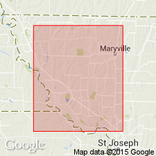
On p. 51 they state: Type locality of Curzen limestone is east of Curzon Station, southeast of Forest City, Holt Co., MO. Reason for apparent change in spelling of name of station since Gallaher worked there has not been learned. It is assumed Gallaher had opportunity to secure correct spelling and that RR may have changed spelling through error. Named from Curzon, Holt Co., MO.
Source: US geologic names lexicons (USGS Bull. 896, p. 557; USGS Bull. 1200, p. 1014).
- Usage in publication:
-
- Curzon limestone member*
- Modifications:
-
- Overview
- AAPG geologic province:
-
- Forest City basin
Summary:
Pg. 2035; G.E. Condra, 1949, Nebraska Geol. Survey Bull., no. 16, p. 21; F.C. Greene and W.V. Searight, 1949, Missouri Geol. Survey and Water Res. Rpt. Inv., no. 11, p. 18. Curzon limestone member of Topeka formation. Overlies Iowa Point shale member; underlies Jones Point shale member. Age is Late Pennsylvanian (Virgilian). This is classification agreed upon by State Geol. Surveys of Iowa, Kansas, Missouri, Nebraska, and Oklahoma, May 1947.
Source: US geologic names lexicon (USGS Bull. 1200, p. 1014).

- Usage in publication:
-
- Curzon limestone member
- Modifications:
-
- Areal extent
- AAPG geologic province:
-
- Forest City basin
Summary:
Pg. 16, fig. 5. Curzon limestone member of Topeka limestone. Variable in texture; commonly divided into two or three units by thin shale partings. Near Thurman, Fremont County, Iowa, a fine-grained sublithographic brecciated bed that contains soft green shale within the fractures is common near top of member; in Mills County, to the north, upper beds are thicker and contain dark-brown chert; near Howe, Adair County, to the northeast, it is made up of light-gray OSAGIA-bearing bed overlying fine-grained massive fossil-bearing limestone; west of Macedonia, Pottawattamie County, it is composed of alternating shales and limestones. Thins northeastward; thickness 9 feet near Thurman; 6 feet near Macedonia; about 3 feet near Howe. Underlies Jones Point shale member; overlies Iowa Point shale member. Age is Late Pennsylvanian (Virgilian).
Source: US geologic names lexicon (USGS Bull. 1200, p. 1014).

- Usage in publication:
-
- Curzon Limestone Member
- Modifications:
-
- Overview
- AAPG geologic province:
-
- Forest City basin
Summary:
(Paleozoic Era; Pennsylvanian System by J.M Jewett, H.G. O'Connor, and D.E. Zeller, p. 38.) Curzon Limestone Member of Topeka Limestone. Readily identifiable throughout northeastern Kansas but is not differentiated or is doubtfully identified in southeastern Kansas. Consists of two or more beds of massive bluish-gray, brown-weathering limestone that is mostly hard and resistant, forming a prominent escarpment. Nodules of chert are common. Fusulinids are sparse to abundant in the lower and middle parts of the member, together with some brachiopods and other invertebrates; bryozoans and echinoid remains are common in the upper layers. Thickness 5 to 12 feet. Occurs above Iowa Point Shale Member and below Jones Point Shale Member, both of Topeka Limestone. Age is Late Pennsylvanian (Virgilian).
Source: Publication.
For more information, please contact Nancy Stamm, Geologic Names Committee Secretary.
Asterisk (*) indicates published by U.S. Geological Survey authors.
"No current usage" (†) implies that a name has been abandoned or has fallen into disuse. Former usage and, if known, replacement name given in parentheses ( ).
Slash (/) indicates name conflicts with nomenclatural guidelines (CSN, 1933; ACSN, 1961, 1970; NACSN, 1983, 2005, 2021). May be explained within brackets ([ ]).