The National Geologic Map Database is migrating to a new infrastructure. We apologize for any service disruptions during this process.
|
|---|


- Usage in publication:
-
- Cumberland Head shales
- Modifications:
-
- Original reference
- Dominant lithology:
-
- Shale
- AAPG geologic province:
-
- Appalachian basin
- New England province
Summary:
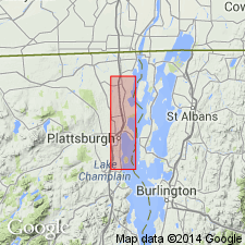
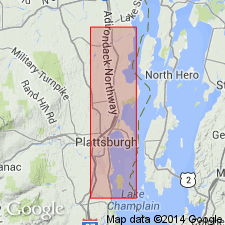
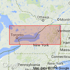
Map forming pl. 13. [On this map (of portion of towns of Plattsburg and Peru, Clinton County)], Cumberland Head shales block is placed above Trenton limestones. Age is Middle Ordovician.
[Named for Cumberland Head, Clinton Co., NY.]
Source: US geologic names lexicon (USGS Bull. 896, p. 554-555).
- Usage in publication:
-
- Cumberland Head shale
- Modifications:
-
- Areal extent
- [Age modified]
- AAPG geologic province:
-
- Appalachian basin
Summary:
H.P. Cushing and Rudolf Ruedemann, p. 97. Correlated Cumberland Head shale with upper part of Trenton limestone of Trenton Falls and Watertown region, and called underlying limestone Trenton limestone. [Age is Middle Ordovician.]
Source: US geologic names lexicon (USGS Bull. 896, p. 554-555).

- Usage in publication:
-
- Cumberland Head shale
- Modifications:
-
- Areal extent
- [Age modified]
- AAPG geologic province:
-
- Appalachian basin
- New England province
Summary:
Pl. 27. Correlated Cumberland Head shale of Champlain Valley with middle and lower Trenton and as = Canajoharie and Snake Hill shales of east-central New York. [Age is Middle Ordovician.]
Source: US geologic names lexicon (USGS Bull. 896, p. 554-555).
- Usage in publication:
-
- Cumberland Head shale
- Modifications:
-
- Areal extent
- AAPG geologic province:
-
- Appalachian basin
- New England province
Summary:
Pg. 39. For shaly phase of upper Trenton typically developed along East Canada Creek below Dolgeville, Herkimer County, Cushing, 1909 [New York State Mus. Bull., no. 126, p. 20, 21 footnote] has proposed the name Dolgeville shale. These shales were previously described by Cushing as "Trenton-Utica passage beds." In Lake Champlain region to the north and east from Plattsburg somewhat similar passage beds of uncertain stratigraphic equivalency have been mapped as Cumberland Head shale by Cushing, 1905 [New York State Mus. Bull., no. 95, p. 271-453].
Source: US geologic names lexicon (USGS Bull. 896, p. 554-555).
- Usage in publication:
-
- Cumberland Head shale
- Modifications:
-
- Areal extent
- Dominant lithology:
-
- Shale
- AAPG geologic province:
-
- Appalachian basin
- New England province
Summary:
Pg. 108-116. Cumberland Head shale (Cushing 1905, pl. 13) consists of blue-black slaty limestones and calcareous shales with some firmer limestone bands. Replaces Canajoharie shale on New York side of Champlain basin. Lithologically very different from Canajoharie shale of Panton shore and southern Champlain basin in general, for prevailing element is slaty limestone and graptolite shale was not observed at all. Beds are strangely barren of fossils, but those found suggest lower and middle Trenton. Are probably in part at least = Canajoharie shale, but are lithologically and faunistically a differerent facies and deposited under different conditions if not in a separate basin, therefore deserve separate name. Overlain by Stony Point shale and underlain by Trenton limestone. [Age is Middle Ordovician.]
Named from Cumberland Head, near Plattsburg, NY.
Source: US geologic names lexicon (USGS Bull. 896, p. 554-555).
- Usage in publication:
-
- Cumberland Head formation
- Modifications:
-
- Areal extent
- Revised
- Redescribed
- Reference
- AAPG geologic province:
-
- Appalachian basin
- New England province
Summary:
Geographically extended the Cumberland Head to VT and revised it to the Cumberland Head formation of the Trenton group. Reference region is South Hero Island, Grand Isle Co., VT, 2 miles southeast of Cumberland Head. Redescribed as including argillaceous limestones and limestone-bearing black shales overlying lowest Sherman Fall Shoreham limestone and underlying Stony Point black shale. Thickness is typically 150 feet.
Source: GNU records (USGS DDS-6; Reston GNULEX).

- Usage in publication:
-
- Cumberland Head argillite
- Modifications:
-
- Revised
- Dominant lithology:
-
- Argillite
- AAPG geologic province:
-
- Appalachian basin
- New England province
Summary:
Revised the Cumberland Head to the Cumberland Head argillite in NY. Unit is of Middle Ordovician (Mohawkian) age.
Source: GNU records (USGS DDS-6; Reston GNULEX).
For more information, please contact Nancy Stamm, Geologic Names Committee Secretary.
Asterisk (*) indicates published by U.S. Geological Survey authors.
"No current usage" (†) implies that a name has been abandoned or has fallen into disuse. Former usage and, if known, replacement name given in parentheses ( ).
Slash (/) indicates name conflicts with nomenclatural guidelines (CSN, 1933; ACSN, 1961, 1970; NACSN, 1983, 2005, 2021). May be explained within brackets ([ ]).