The National Geologic Map Database is migrating to a new infrastructure. We apologize for any service disruptions during this process.
|
|---|


- Usage in publication:
-
- Cuervo Sandstone Member
- Modifications:
-
- Named
- Dominant lithology:
-
- Sandstone
- AAPG geologic province:
-
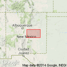
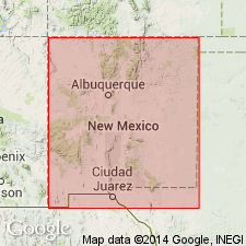
- Palo Duro basin
Summary:
Named for exposures (its type section) along Cuervo Creek and town of Cuervo, sec 4, T12N, R25E, San Miguel Co, NM in the Palo Duro basin. Overlies lower shale member of Chinle. Underlies upper shale member of Chinle. Measured sections. Ranges from 155 to 224 ft thick. Geologic map; mapped in northeast corner of east sheet in Guadalupe and De Baca Cos, NM, also in the Palo Duro basin. Consists of: 1) basal gray, medium-grained sandstone that is conglomeratic at base; 2) red-brown mudstone with pebble conglomerate; 3) gray, pebble (of limestone, sandstone quartz) conglomerate; 4) gray and buff, medium-grained micaceous sandstone; 5) gray, thin-bedded sandstone and siltstone; 6) buff, medium-grained, micaceous sandstone with some lenticular pebble conglomerate beds; 7) gray, brown siltstone with some medium-grained sandstone; 8) buff, medium- to coarse-grained, thin- to thick-bedded sandstone that total 224 ft thick at type. Triassic age. Stratigraphic table.
Source: GNU records (USGS DDS-6; Denver GNULEX).
- Usage in publication:
-
- Cuervo Member
- Modifications:
-
- Not used
Summary:
A medial sandstone in the upper Triassic rock section in the Tucumcari basin is the same rock as was named Trujillo Formation by Gould (1907). Gould's term predates Cuervo Member of Chinle established by Kelley in 1972 for the same sandstone. Therefore, Trujillo recognized by authors in preference to Cuervo, a term considered by them to be superfluous. Term Chinle Formation of Colorado Plateau thought to have been deposited in a different basin than the Upper Triassic rocks of east-central NM. Chinle not used in report area and replaced by (ascending) Garita Creek, Trujillo, Bull Canyon, and Redonda Formations. Nomenclature chart.
Source: GNU records (USGS DDS-6; Denver GNULEX).
For more information, please contact Nancy Stamm, Geologic Names Committee Secretary.
Asterisk (*) indicates published by U.S. Geological Survey authors.
"No current usage" (†) implies that a name has been abandoned or has fallen into disuse. Former usage and, if known, replacement name given in parentheses ( ).
Slash (/) indicates name conflicts with nomenclatural guidelines (CSN, 1933; ACSN, 1961, 1970; NACSN, 1983, 2005, 2021). May be explained within brackets ([ ]).